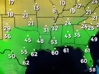
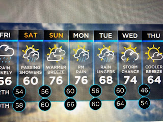
When you see dew points still 60+ at Houston, you know it isn't much of a front. There is another, stronger upper storm moving into the West Coast today that will pull the front to our south northward on Sunday getting us back into the warm air sector.
As the warm front returns to the north, there could be some showers with it Sunday morning, but we should see some sunny breaks during the afternoon allowing temps to soar back into the mid to upper 70s. While we stay warm, a snow storm will be traveling our of the Rockies into the Great Lakes and then to New England. We still have no signs of an Arctic outbreak coming during the next 7-10 days.
And finally for you snow lovers, here's my dog Bailey playing in my yard after the last real snow here. I think the year was either 2017 or2018? Whatever, it's been a long time. I wouldn't mind a February snow since we know March/Spring is coming and it won't last very long. Keep dreaming. Stay tuned!


No comments:
Post a Comment