Monday, August 31, 2020

Nana Forming Off East Coast? Or In Caribbean?

The Tropics are certainly active, although this morning we have no named storms to track.  NHC has highlighted 4 areas to follow, but none of them look to be our concerns right now.


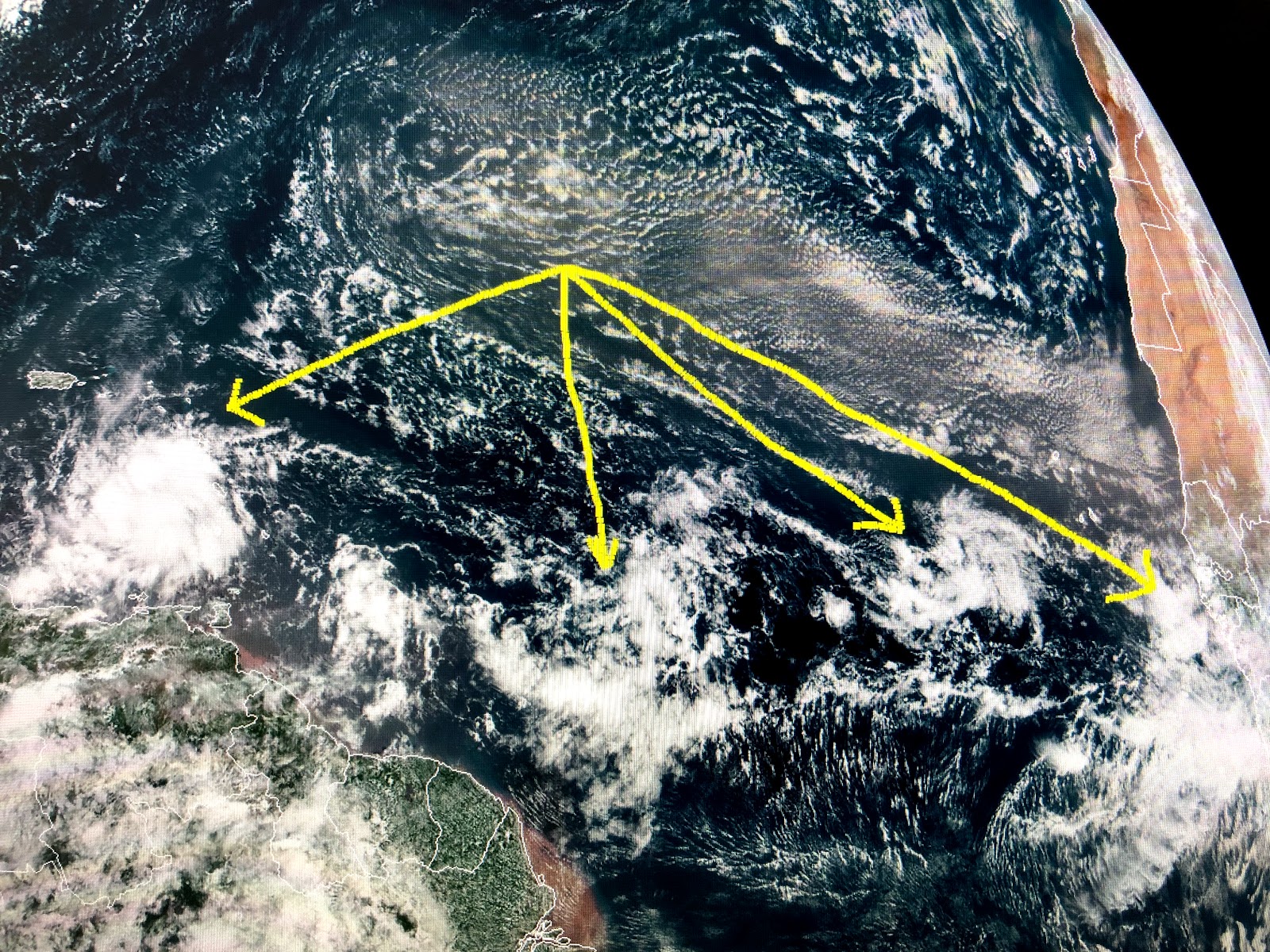
There are waves coming off of Africa every three days, but none of these shows any rotation and development is expected to be slow.  So rather than look way out, let's focus on what's closer.


The disturbance racing to the west south of Hispaniola does have a spin and could become a depression later today.  With such fast forward motion, most computer models keep it going straight into central America and not veering northward into the Gulf.  The system off the east coast will probably be named first.


It's hooked on to an old frontal boundary, but the daylight (visible) satellite loop & coastal radar views clearly indicate a spin developing.   It will be interesting to see how quickly NHC upgrades this system since it will move out to sea and never affect any land areas.  So in the short term, we have zero tropical threats here for the next 5-7 days.


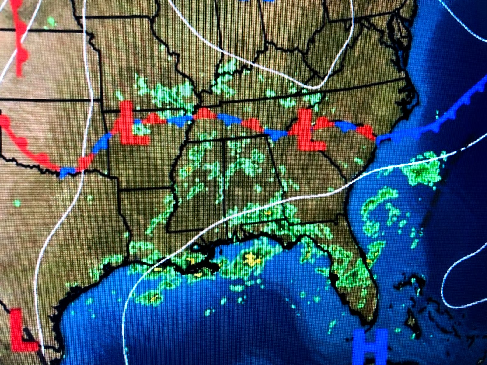
Today marks the end of Meteorological Summer, but before we start seeing cold fronts, it has to get cooler up north.  That is happening as 30s & 40s are showing up across the Rockies into Canada.  Models are bringing some of that air down to us NEXT week!   Be patient my friends.   I was watching a reporter on one of the networks covering Laura's damage in Lake Charles.  He began by saying..."Here we are 4 days after landfall and many are still without power".  Duh!  He obviously has never been through a major storm.
4 days is nothing.  heck, it takes that long just to clear the fallen trees and poles off the streets.  It'll take many weeks, perhaps months, before the power grid is fully restored.  Keep them in your prayers.

  Finally, September begins National Childhood Cancer Awareness month and Brenda and I are passionate supporters of CAPS FOR KIDS, a national non-profit organization for children battling cancer, which is based in New Orleans and serves over 150 pediatric oncology hospitals (including St. Jude's)in the U.S.

September 6th is the 26th anniversary of CAPS FOR KIDS creating smiles for children with cancer by connecting them with their celebrity hero to autograph their baseball caps to wear during their chemo treatments which fills these children with courage & hope & makes them feel special.

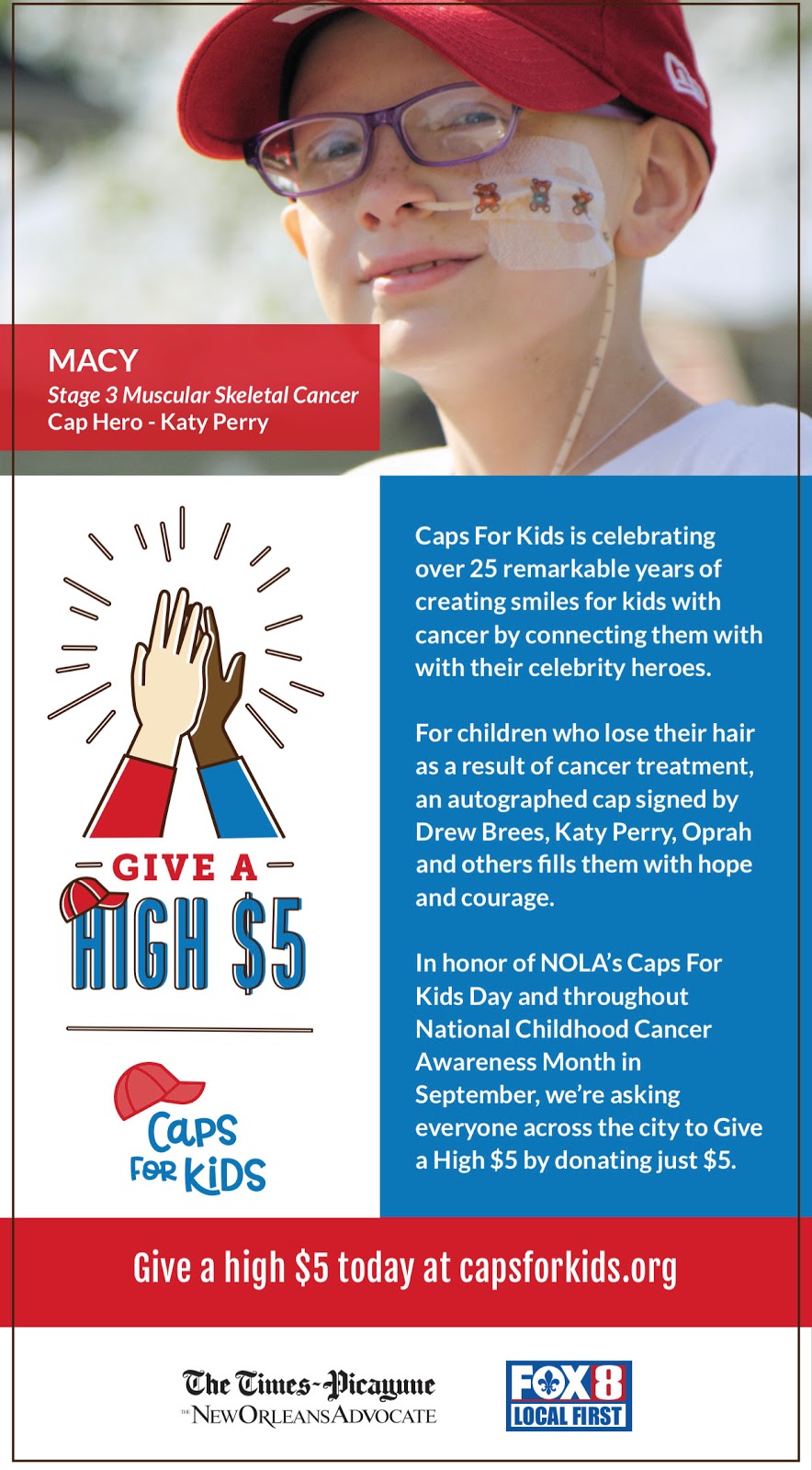
We are delighted to have FOX 8 join us as our local media partner as we are asking for everyone to "Give a High Five" by donating $ 5 (or more) to help Caps For Kids connect more children battling cancer with their own Cap Hero.  More than 15,000 children each year are diagnosed with cancer in the U.S. If you are able to help us help kids, please visit


A young child losing his/her hair can be such a painful experience, but getting a cap from their Hero eases that pain.   Can you join us in helping kids?   Brenda and I really appreciate your time and support.  Stay tuned!


Sunday, August 30, 2020

It's The Waiting Game...

There really isn't any news to update tonight as NHC continues to highlight multiple areas for possible development.  Nothing is threatening to any land areas right now and the thinking is it may stay that way for awhile.


The areas way out in the Atlantic are 2 weeks away from us so I won't even waste time talking about them.  The disturbance over the eastern Caribbean does appear to be trying to rotate but NHC keeps the chances for organizing the same at 80%...translation...it will happen.  The system off the east coast remains at 70% chance for development so we'll have to see which one becomes Nana and which one will be Omar.  As you can see, most early computer models take it straight westward into central America.

the other system off the east coast will quickly head out to sea as another name will be "wasted" on this year's list.


The frontal boundary to our north has stalled out, but it is kind of exciting to see the dramatic difference in air masses with dew points in the 40s & 50s north of the front.   Models continue to hint we'll see our first Fall front sometime during the next 10-14 days, and that would be nice!


With the current lull in tropical activity, I've been looking back over the years at old Ch. 8 tracking charts and seeing some of the folks I worked with.  In the 80s it was New Yorker Joe Cioffi who had not only weather knowledge, but a great sense of humor.  I went to Joe's wedding back in the 80s because he insisted I see a "real New York Italian wedding".  You won't believe it and Joe was right.  It was 4 days of eating & drinking.  I put on 6 lbs.!   Ch. 8 promoted us with billboards "On your side".  I think after Ch. 8 dropped that slogan, Ch. 6 pick it up in the 90s!  Joe left us to go to a Cable TV station in Long Island to be closer to family.   Next update Monday morning.  Stay tuned!

Coming Soon? Nana, Omar & Paulette

We, historically,  are in the most active part of the Hurricane Season and 2020 is proving that to be accurate.  Waves are lined up over Africa, out into the Atlantic and now into the Caribbean.   So far we have no named storms to follow but that will change.


I've highlighted 4 areas to watch and NHC believes the farther westward one will become our next named storm (Nana) in 1-2 days.  This disturbance has become better organized today but T-Storms are not tightly clustered just yet.  Still NHC has increased chances for developing up to 80%.


We are still in the favorable (rising air) of the MJO so don't be surprised to see several named storms happening at the same time.   If Nana doesn't form quickly, there is a frontal boundary along the East coast into the northern Gulf that has a weak low rotating just east of the Georgia coast and NHC gives that a 70% chance to develop.  So we could have Nana & Omar at the same time.  We need not worry about the east coast disturbance since it'll race out to sea.  The Caribbean system RIGHT NOW, appears to be at a low latitude streaking to the west that would take it into central America, but that could change.


So the real question should be...which one will be first?  Nana & Omar should form before Tuesday. 
We are just north of that boundary that lingers along the northern Gulf Coast with heavy storms training over the same areas.

Where it's storming, look how much cooler it is. Where it's sunny it feels like summer.  The surface map doesn't show any fronts coming our way just yet.  However, note how much drier (lower dew points) it is north of Tennessee.  The real coolness remains up in Canada, but models still hint we could see some of that the second week in September.


Finally, I showed you yesterday some of my old tracking charts.  Today I highlight Ken Aucoin and Al Duckworth and Howard Bernstein.


Ken stayed with me for 16 years before leaving to be the Chief Meteorologist at WIS-TV in Columbia, South Carolina. He later left television for a position in emergency management.  The late Al Duckworth came over from Ch. 4 but only stayed for 2 years.  He had the best voice of all the weather people I worked with.  Howard Bernstein joined me in the late 80s and moved on to Oklahoma City, Rochester and then Washington D.C. where he has been for 20 years.  I am proud to have mentored so many who moved on to greater success.  Next update later tonight.  Stay tuned!

Saturday, August 29, 2020

The Way We Were...

Looking back at all the technological improvements since I first entered broadcasting in February 1971, gets me thinking about the lines in an old Barbara Streisand classic song...
       Can it be that it was all so simple then,
       or has time rewritten every line.
       If we had the chance to do it all again, would we, could we?
       Memories may be beautiful and yet...

When I started in 1971 in Tampa we used paper maps with Plexiglas coverings and hand drew our fronts with felt tip pens.  Now it's all computerized.  Watching David display the newest graphics, including predicted storm surges, was indeed beautiful during Hurricane Laura.  To the song I'd add this to the line "if we had a chance to do it all again", should we?   The obvious answer is no since modern technology allows us to produce graphics that way better display the dangers of storms and who is at greatest risk.  But looking back does have some neat memories...

Like my being the kid joining two NOLA Legends, the late Buddy D. and late Alec Gifford.


Perhaps you remember the sign on the bus promoting...err. shampoo!  Wow!  But what I remember is our yearly hurricane tracking charts.


Ch. 8 produced charts for 30 years before that type of information was shifted to our station web site.  The picture above has me joining Nancy Russo & the late Mike Herrera.  Nancy went on to Houston, Washington D.C & Boston before returning to Ch. 4 here in NOLA.  She retired to raise her children.  Mike was the long time station announcer for Ch. 8 and you heard his voice on many commercials.  Since we are in a quiet period, I'll try to highlight some of my past co-workers during the next week.


NHC now is watching 3 areas for possible development.  The newest is off the east coast as a frontal boundary sinks offshore early next week.  The others are out in the Atlantic so we'll have plenty of time before we need to get concerned


The Caribbean and Gulf are quiet except for a cluster of storms over the NE Gulf heading away from us.  Locally, some storms have bubble up during daytime heating as summer lingers on.  There are hints that our first pre-Fall front might arrive during the second week in September.  I'm just trying to give y'all some hope!  Stay tuned!