Good evening everyone, Bob is still with out access to the internet as I'm sure most everyone is in the NOLA area. His house has sustained some roof damage and he has multiple leaks. A large tree also came down in the winds. Luckily it fell away from the house. It could have been much worse.
Monday, August 30, 2021
Sunday, August 29, 2021
Ida Begins a Slow Weakening Process...
Bob has lost the internet at his place, so we are posting this for him.
At this stage, the only things to show are radar & satellite views along with wind speeds and wave heights. Landfall was at Port Fourchon and she's now moving over Golden Meadow heading just to the east of Houma.
All of southeast LA/MS are under the heavy rain shield. As these radar views show.
Ida has a classic satellite presentation, especially on the color IR pic....totally symmetrical with a core eyewall.
The strongest winds will be moving over NOLA during the 3pm to 6 pm time frame. Note how many wind stations south of us are no longer reporting.
The only good news is wave heights are coming down from earlier, but it will take many hours for Ida's furry to wane. Stay sheltered in place as this is my final post until the internet returns. Will be back when the weather improves.
Ida's Eye Wall Reaches the Coast as Cat. 4...
As Hurricane Ida makes landfall just to the west of Port. Fourchon, our hearts go out for Grand Isle which is taking the full force of the storm. Satellite and radar loops are impressive clearly showing a well formed symmetrical major hurricane.
During the next several hours, the winds and the rain intensity will be increasing making it very dangerous to be outside. All local officials are pleading, begging for folks to stay inside during the worst of the storm. David had this graphic that showed where the worst winds will occur.
Please note the time above his head. Even at 6 PM we'll still be feeling the worst winds. Radar views have the approaching rain shield & squalls.
The band of heavy rain/squalls over Mobile Bay is far worse than what we in the city are feeling, but our time will come. Ida's center has reached 80.0 W. longitude and she's still moving at 13 mph to the NW.
The 10 AM center line track is pretty locked in. Note Morgan City , Houma & Baton Rouge will be on the weaker side of this storm.
Winds are slowly increasing and I've just had my first power outage. I'm on generator power and the internet is still working. The next concerns will be rainfall and surge.
Computer models still have 10-15"+ and that will cause lots of street flooding. Remain sheltered in place. Do not drive around during the height of Ida.
David showed where the highest surges will occur. We are nearing landfall during the next 2 hours.
Ida Has Become The Predicted Monster, Almost a Cat. 5...
Cudos to NHC for being very consistent in their messaging with Ida. From the get go their track has varied only 30-40 miles and that's remarkable from 5 days out. What has changed over night is the strength of Ida, rapidly intensifying to almost a Cat. 5. (150 mph) The Eyewall has reached the coast and the Eye itself has moved west of the mouth of the River.
The 4AM center line track hasn't changed since last night, so the eastward shift has stopped. What we need to see during the next 5-10 hours is the center to go slightly west of the NHC forecast so metro NOLA doesn't get clipped by the eyewall winds.
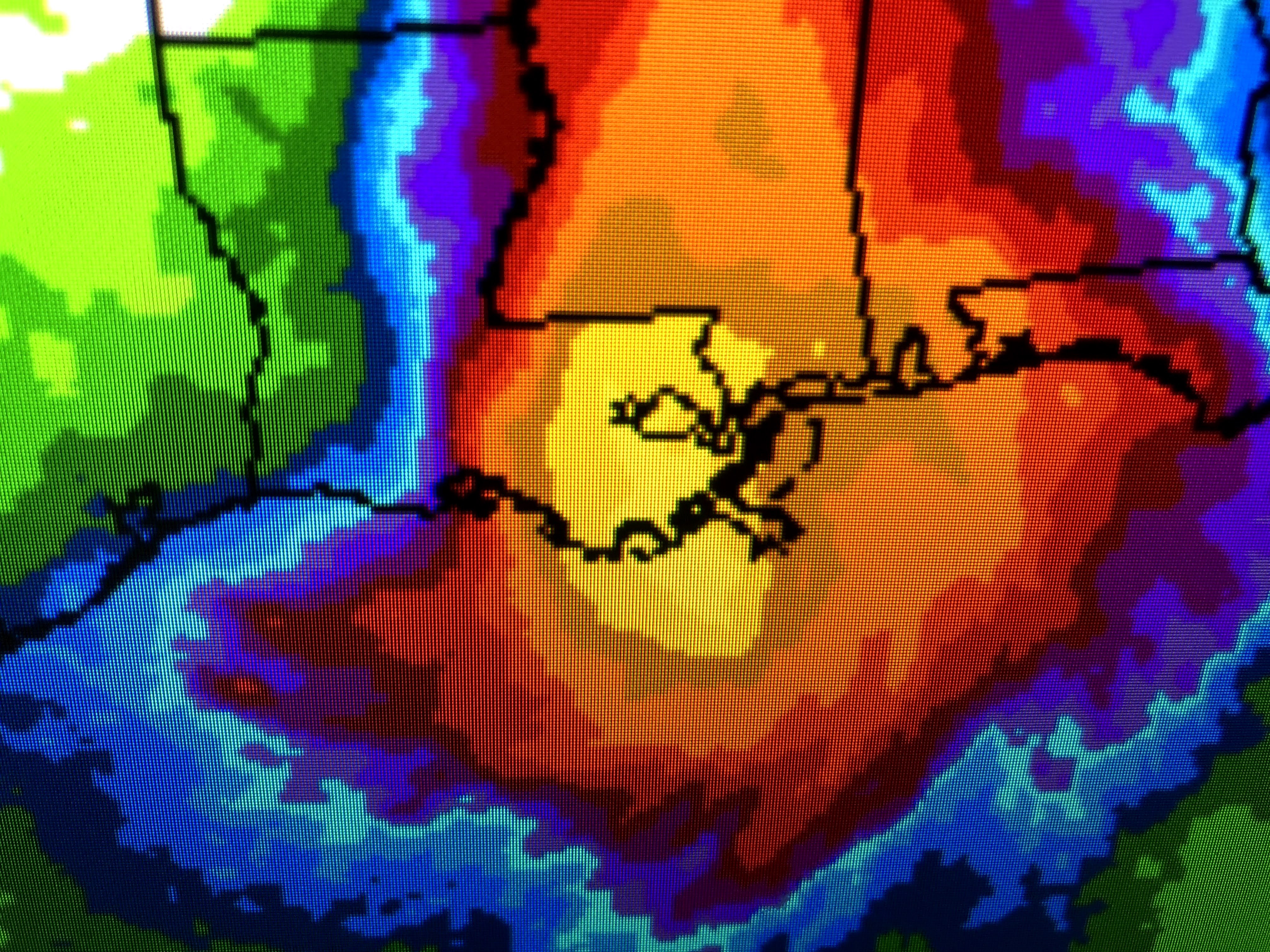
The worst impacts will hit from Grand Isle to Kenner to Hammond westward. Even the heart of the city could see 100+ gusts since Ida has become stronger. Here's the current radar views.
There is a heavy band of rain over the North Shore, but not much south until you reach the coast. Zack Fradella used future radar to show where the eyewall will go.
The far eastern part of the eyewall clips NOLA You can see the cities west of MSY that will feel the brunt of the storm.
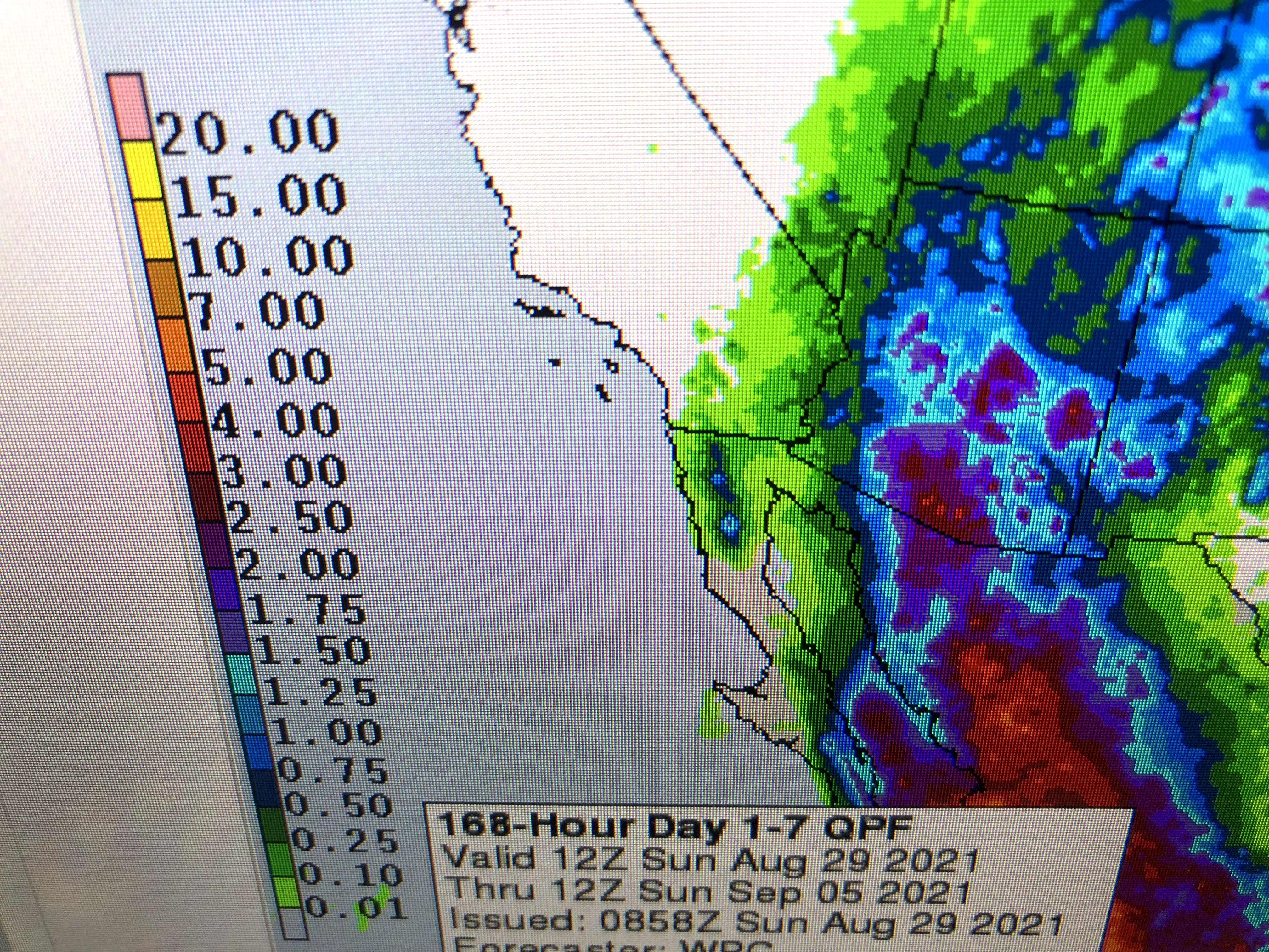
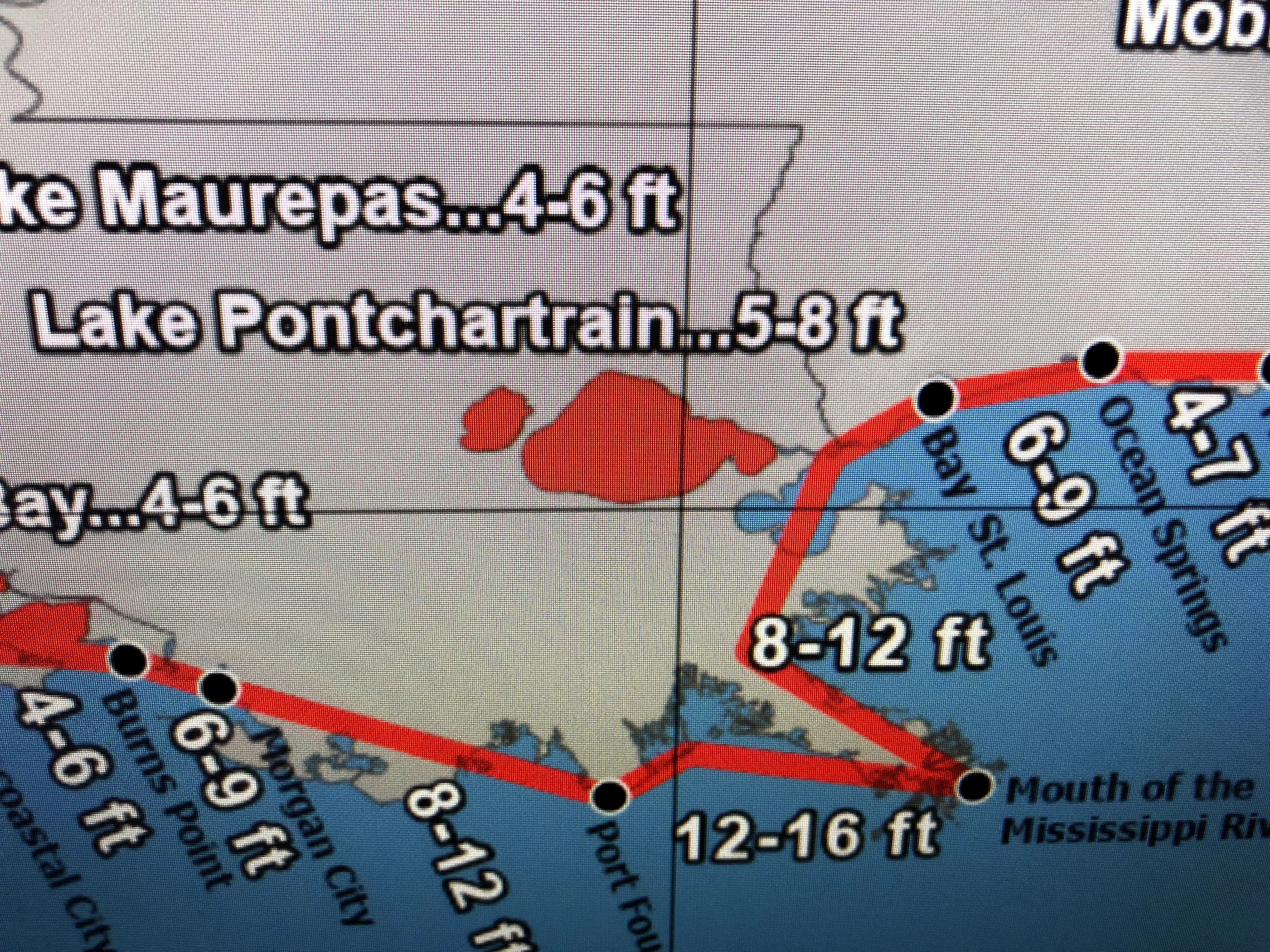
The other major change from NHC is a higher storm surge since Ida is stronger. Now the Mississippi coast will see 6-8 feet+ which will probably put wat up on Hwy 90. Grand Isle's surge could be 16'+ with up to 8; in Lake P. Look at the wave heights offshore!
Winds are still rather tame, but they will quickly ramp up after 10 AM. So the table has been set for days. We've known the danger was coming. The predictions have been super accurate. Now it's time to "hunker down" and pray. My blog posts are internet dependent so I might have to switch over to my son (Rob) in Colorado later today when cable goes out. He has set up a link for you to send damage photos , but don't go taking them until AFTER the winds subsides.
photos@bobbreck.com
A final note...landfalling hurricanes often have quick burst tornadoes that give little warning time, if any. When you get into a heavy rain squall, be prepared to be in your "safe room" in case a tornado dips down. Stay safe and my next post will be at 10 AM. Let's keep hoping the eye drifts farther to the west of Port Fourchon keeping the eyewall winds from the city.
Saturday, August 28, 2021
Ida Track Eastward Shift Continues, Higher Winds Likely For NOLA...
Unfortunately, the eastward shift trend in the center line track continues and that means more of Metro New Orleans will experience wind gusts to 75-80+ during the daylight hours on Sunday. Could that shift stop and switch back a little westward? Sure, but models have been in remarkable agreement with this storm and they all agree (consensus) on the eastward shift. Here's the new track versus the old.
The middle map is the newest center line track. The bottom is from 4 PM. The the center line was over Houma then baton Rouge. The newest (middle map) is shifted 15-20 miles to the right (east). What does that mean? The eye wall winds (100+) will now be over Grand Isle, Lafitte, Kenner, Covington up to Folsom. IF this shift verifies, Morgan City/Berwick and even Houma/Thibodaux would see lesser impacts since they would be on the weaker side of Ida. However, there is still time for that center line to shift back to the west. NHC is keeping Ida's max winds at 105 mph despite the central pressure falling 5 mb in 4 hours down to 964. Satellite views tell a different story.
The eye clearly stands out and the color IR view has the "donut look" starting to form with a circular eyewall around the center. Ida may already be a Cat. 3, but there was mechanical issues with the Recon plane so we haven't had new data since 8 PM. The radar view is less impressive, but that's because Ida's circulation is just coming into range.
The timing of strong winds hasn't changed with tropical storm force winds arriving along the coast after midnight and up over the city around daybreak and to the North Shore before noon. It will not be safe to be outside after 9-10 AM with the strongest winds happening between noon & 8 PM for most of us. that means Ida will make landfall during the daylight hours. I won't go over the impacts since you can find that on all the local channels. My personal feelings believe the centerline will end up back farther to the west. That is based on what I'm seeing watching satellite & radar loops, plus seeing the forward speed not slowing down (NW 16). This will be a major impact storm for many, but it will be life altering for those who get into the eye wall. Several of you took offense at my use of "Monster" on my last post saying I was scaring you. My intentions were just that. Fear often gets people to change their minds regarding evacuation. My intention was to get those able to leave, to leave. Sorry if I scared those of you unable to leave. My experience after a big weather event is people scream out..."why didn't you tell us it would be this bad". Fact is, we did but you chose to hear only what you wanted to hear. Again, this will be a MONSTER storm for some. There is still about 4-6 hours to drive out and escape the effects of Ida. If you can, go. I'll post in the morning before 8 AM. Stay tuned!
Subscribe to:
Posts (Atom)