The current upper pattern has the trough to our west with a weak ridge over the Southeast. Radar matches the returns with the brightest clouds. Look how the computer guidance builds the upper high over us.
We should see 3 straight days of 90+ before the high retreats southward ahead of a digging East Coast trough by Tuesday of next week.
With no fronts around us and an upper high building right over us, I just don't see much shower activity to keep us below 90.
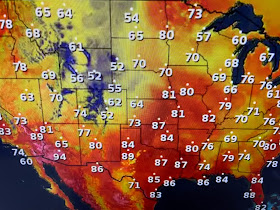
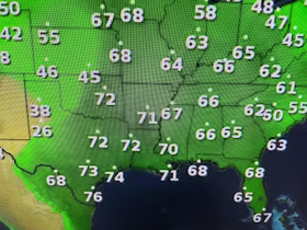
It's still pretty chilly unto the upper lows & trough. All the severe storms are along the line of sharp dew point spreads. The DP in Wichita is 45 while in Tulsa it's 72!
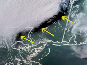
All the big storms remained well north of us, but they created an interesting shadow effect with the setting sun (yellow arrows). I hate talking about the heat already since in won't change much for the next 4 months. Until the heat index tops 105, I really don't get too concerned. Gotta water my potted plants almost daily for the next 3 days. Stay tuned!


No comments:
Post a Comment