The 4 PM update from NHC has nothing new as powerful Cat. 4 (nearly Cat. 5) Hurricane Beryl quickly races westward south of Puerto Rico. Hurricane are nature's most powerful storms and when they reach maximum intensity, they are beautiful to observe from afar. Beryl has the classic symmetrical eyewall surrounding the mostly clear 20 mile wide eye. I begin with satellite views.
This path/track takes Beryl right over the highest oceanic heat content (middle graphic) which could keep her strength intact. NHC is hoping some upper wind shear (bottom graphic) will start a weakening trend tomorrow. But what if that doesn't happen? Typically, stronger storms want to turn to the north while weaker storms stay embedded in the tropical easterly flow. The position of the upper heat dome over us will block Beryl from coming to us. But we need to watch to see if there is any turn to the north on Tuesday. How will we know that? By following the centerline track as I have in this city for the past 45 years. Let's look at the subtle change in that track since 11 AM.
Can you see it? The middle graphic is the 11 AM advisory while the bottom is from 4 PM. NHC nudged it slightly to the north closer to Jamaica. Parts of Haiti are now in the cone. We don't want Beryl to end up going north of Jamaica. The farther south is better for us. Check all the models.
All bring Beryl into the Yucatan with a few turning northward into western Louisiana. None of the models turn Beryl north of Jamaica. Here's what I'll be looking for tomorrow and Wednesday.
The upper heat dome protects us RIGHT NOW. Note there is a deep upper trough along the east coast of the U.S. Could Beryl turn into that? Probably not, but I want you thinking and not just buying into all the models. Bottom line, there is nothing to indicate Beryl will ever be a threat to the northern Gulf. But as I said yesterday, expect the unexpected. Before knowing where Beryl might go, here's a quick geography lesson.
Not sure why any of you would be going to Jamaica, the Caymans or Cancun during hurricane season, but these are the places most likely to see serious impacts. Locally, we still have excessive heat warnings.
So if you're looking for any heat relief between now and late September, it'll be from daily showers.
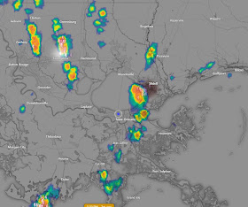
We do have a few boomers around, but highs have been flirting with 100 today. Expect more of the same tomorrow. Stay tuned!


No comments:
Post a Comment