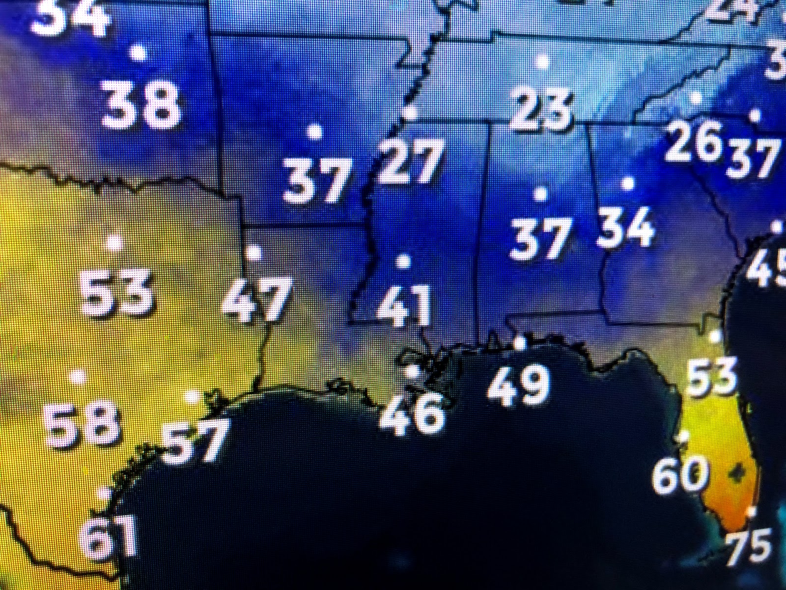
It has been a long time (6-8 weeks) since we've seen a large Arctic high pressure system cover the eastern 2/3 of the nation. Fortunately the core of the core will be to our north and east, but tonight will see a moderate freeze on the North Shore and a light freeze on the South Shore away from Lake Pontchartrain.
Areas to our east (Mobile, Pensacola, Destin) will be colder than NOLA. You can clearly see the cold air pouring down over the Gulf as satellite views show the north to south cloud streets off our coast. Tuesday should be another bright, sunny day, but highs will struggle to top 50 once again.
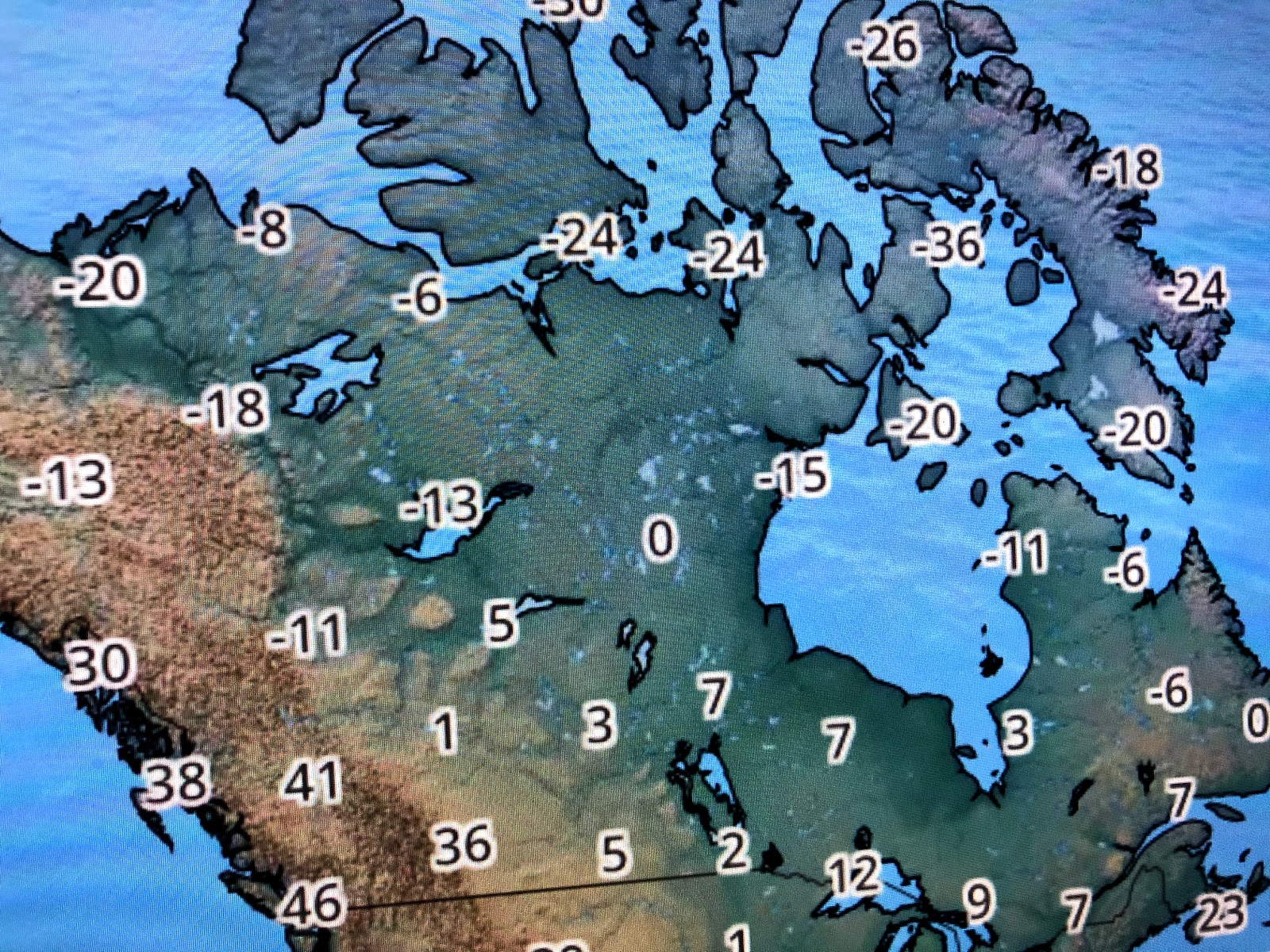
Our next storm system is along the West Coast and it'll bring increasing clouds on Wednesday with showers for Thursday into early Friday. We'll also be warmer but the warm up will be brief. The super cold (40-50 below) air has retreated by up to northern Canada & back into Alaska for now.
However, long range computer models hint at another Arctic outbreak coming for the first week in February. But our focus should be on tomorrow morning's lows. My thinking is 24-28 on the North Shore (full precautions needed) with the South Shore 30-35 except 35-38 closer to Lake P. Remember the "Pipe Rule". Don't run your water unless temps get below 28 degrees for 4 hours or longer, That will only happen on parts of the North Shore. Stay tuned!


No comments:
Post a Comment