When Hurricane Katrina was approaching us almost 15 years ago, the local NWS office issued this statement. " Area neighborhoods will be uninhabitable for weeks, perhaps months after Katrina makes landfall". Those of us who stayed sure found out how right they were. Tonight I fear SW Louisiana will endure the same fate.
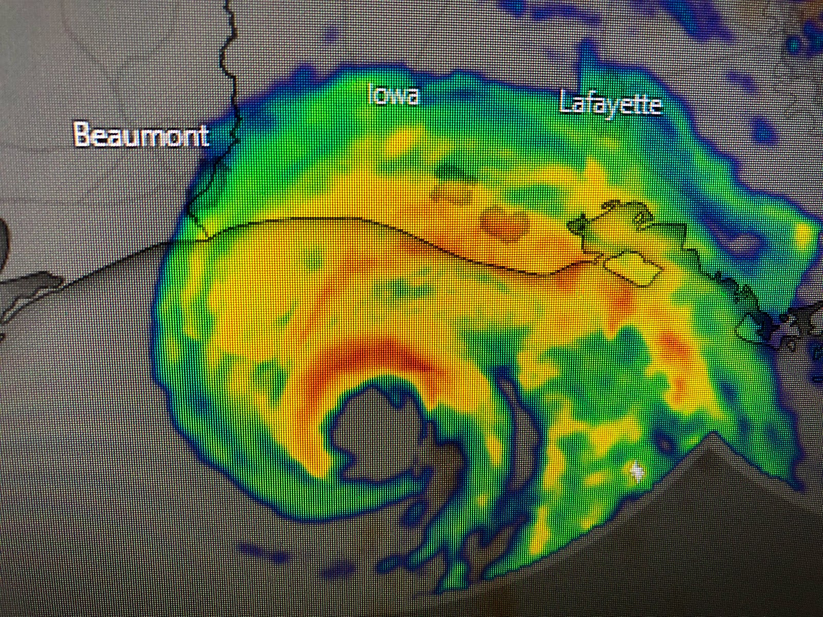
No matter how you look at it, this storms is more powerful than Katrina since Katrina was weakening at landfall while Laura continues to strengthen. The track is now confirmed. Lake Charles is the bullseye. Radar views show the northern eye wall is nearing the coast.
It's too late for any wobbles. The center will cross the coast sometime around 1-2 AM and march northward bringing damaging winds across most of western Louisiana up through Shreveport. Our local impacts have lessen a little as water levels have dropped slightly along with winds and seas. However, those south winds will prevent any significant water drop for another 2 days.
From Jefferson Parish westward, a tornado watch is in effect, however, the real danger should stay far to our west. The 10 pm update is in and it indicates Laura will come ashore as a Cat. 4 with winds of 150 mph. The forward motion has not slowed down (NNW @ 15) which is great news as that means it won't linger like Harvey dumping super amounts of heavy rainfall.
What we need to watch for Tomorrow and Friday are bands of heavy rains wrapping around the circulation of Laura as she heads to the north. There could be training set up under those bands that could cause local street flooding. That's hardly anything what SW LA. will endure tonight. I've been watching TWC and I'm sure they'll have frightening video over night. Until morning, enjoy a good sleep knowing that a major hurricane has missed SE LA/MS.
Finally, my oldest son (Rob) who is the webmaster of my site, asked me what the "hole" was that developed on the north side of Laura. I wasn't even looking up there, but could see an outflow boundary race away from T-Storms not connected to Laura. Always on the lookout for interesting features on satellite views. Stay tuned!


8 comments:
Thanks Bob
Thanks!
Thank you Bob!
Thank you for being there, when we need you.
Thank you Bob for always looking out and keeping us informed . You are appreciated! God bless!
Big Time Thank You....God Bless those in this storm....Allen Bealle
camille is still the stronger
I tell everyone I can that Bob is a weather genius! I remember when Gustav was getting close to Louisiana. He said it looks like it's coming straight for a large sandbar out in the gulf, if it does it will knock the hurricane's strength down a bit and it won't be as bad as everyone thinks it will be. That's exactly the path it took as he said it would.
Post a Comment