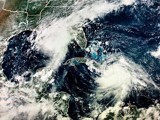
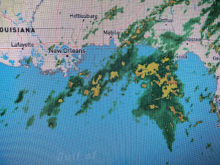
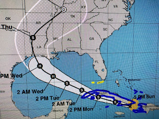
We can't see his center yet on radar, but can you see the huge rain shield on his north and east sides? Even if he makes a left turn before reaching our coast, we will still get in on the heavy rains later tonight and tomorrow. OK, the new track is in and there is some good news for us.
NHC now has the center line track curving to the west a little sooner. IF that proves true, it will mean the strongest (Hurricane force) winds will stay offshore and the wind impacts (power outages) should be less than earlier expected the farther north you go. However, let's not forget the heavy rain threat. Traveling around town on Monday is not recommended. Think of the virus...Stay at home!
As for Laura, the new centerline track has been shifted slightly back to the east (closer to us). We don't want this trend to continue as that will bring the impact dangers back to us. Regardless, we will be on the strongest side of that storm. Let's get through Marco first. We'll have time to deal with Laura later. Stay tuned! Next update after 10 PM.


13 comments:
Thank you for your updates!!
Thank You for keeping us updated!!!!
Thanks. I will be waiting for your 10 o'clock update
Really Bob! I'm in Port Arthur, tx and my husband is in Plaquemine, la. I guess it's headed for me. Good thing I'm prepared.
Thanks! I do have a question when things settle down... why don't we have complete radar coverage of the gulf?
Simple don’t need complete coverage nor the expense. Thus the Hurricane hunters and satellites.
It's scary when you feel the need to peek out of retirement but thanks for doing it!
Did Marco just dissipate?
The IR loops over the past 3 hours show Marco moving due North... we'll know where it's going where it gets there LOL
Thank you Bob!!!
Thank you Bob for the continued updates and insights!
Thank you Bob for all you do... YOU ARE the one man I trust in this insanity !!!
I appreciate your posts so much! Thank you for your updates. ❤️
Post a Comment