I've been showing you a comparison of last year's Cat. 5 Hurricane Dorian to Hurricane Laura as she is now a strong Cat. 3 (125 mph) likely soon to be a Cat. 4. As she keeps getting stronger, her satellite presentation keeps getting "better", although there is nothing good coming with this storm.
The top photo was from 7 AM while the bottom is from 11 AM. Note how the eye has become much more defined. It currently is 25 miles wide. The eye wall is 30-40 miles around that so lots of folks will experience hurricane force winds whether she comes ashore. The 10 AM NHC track remains the same going between Beaumont & Lake Charles.
Based on the Euro model, I'm leaning for a landfall track over Beaumont, and that would bring some higher winds to the Galveston/Houston areas. They still would be on the weaker side of Laura with Louisiana on the stronger side.
The last photo is looking straight down into the eye that shows several swirls. Laura has yet to make the big turn to the north and, if I were in Texas I'd be a little nervous since her forward motion (NW @ 16) hasn't slowed. Could she end up farther to the West? The top photo shows just how large a storm Laura is filling up most of the Gulf. For comparison, look at Laura compared to Rita back in 2005.
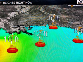
To me Laura looks stronger than Rita and Rita was a beast. Impacts locally are some gusty winds, especially along the coast along with higher tides that will not come down for days since the winds will switch from the east to the south as Laura moves north during the next 2 days.
So far, most of Laura's rain shield is to our south and west. We could see a passing squall later this afternoon but I don't anticipate any flooding rains unless a training band develops over us. Many have asked for information about impacts at THEIR location. That is not the purpose of this blog. Let me suggest you go to the local NWS web page where you can find specific info on many locations.
Finally, there are no systems coming off of Africa, however, David showed a graphic last night indicating a new surge of tropical moisture might follow up into the Gulf behind Laura. Sure enough, I see a cluster of storms has developed over the central Caribbean. I'll be watching that for development during the next 2-3 days. Next update after 4 PM. Stay tuned!


13 comments:
Thank you, Bob!
Thanks Bob. But what about poplarville Ms in pearl River county. We are close to Slidell and I'm closer to bogalusa on the pearl River side
Taken from above...
"Many have asked for information about impacts at THEIR location. That is not the purpose of this blog. Let me suggest you go to the local NWS web page where you can find specific info on many locations."
Many have asked for information about impacts at THEIR location. That is not the purpose of this blog. Let me suggest you go to the local NWS web page where you can find specific info on many locations.
Hey, for folks looking for local information, you might find this link helpful:
https://www.nhc.noaa.gov/text/refresh/index_hls3+shtml/250330.shtml?
It's the "local products" for several of the big cities in Laura's path. In particular, click on the "Threats and Impacts" link for your area and you'll get an interactive map that shows hazard levels for flooding rain, tornadoes, storm surge, and winds.
Thanks for the information
Bob, what about unit #417b at the Gulf Breeze Condos in Orange Beach (specifically the weather at 8pm Thursday over the bedroom in the northeast corner), right next to that Sonic that has really good fountain Coke. Should I cancel our trip?!
You win the internet for today 🤣🤣🤣🤣🤣
Thank you, Bob! I too noticed the cluster of storms over the Caribbean & began to wonder...are you next?
Storm 13 and 14 are West of Mexico right now. Is there any way you can highlight these two storms and the possibility of them becoming hurricanes and affecting the Gulf Coast?
Thanks for all you do, Bob! So glad you're not "Fully" retired, and doing this blog! It has been super helpful!!!
Wow going out on a limb calling landfall location Beaumont,TX a day out. This can only be done with 40 plus yrs experience.
Do you think she'll get to a Cat 5 before landfall?
Remembering 1988 and Hurricane Gilbert. He was a monster, and I recall Bob telling us, while he was still south of Cuba that a really big storm was like a freight train, and once it got up a real head of steam it was hard to turn. Sure enough, we watched Gilbert, Cat 5, navigate across the southern Gulf and not impact the U S at all. Just a memory. These storms are dependent on so many variables that it is a miracle forecasts can be made at all. I am thankful for Bob and the many meteorologists at the NHC who study the incoming data and give us their best estimates of what is coming. God Bless them all. I still trust Bob...
Post a Comment