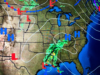
In fact, there are very few showers around the center which you can see as Beaumont's winds are NE while Pt. Arthur has SW winds. There are some squalls rotating onshore over SE LA, but as long as no training of storms occurs, our amounts should stay under an inch.
So once Beta moves out, we start to look to the north for our next cold front. No signs of it coming in the short term, but you can see Canada is getting chilly with many locations below freezing. The blocking high over the east coast will drift offshore allowing Beta's remains to start accelerating.
Since we are still on the wet side of this system, you can see how the 70+ dew points are back. Until Beta passes to our east, wind directions will stay off the Gulf piling water up into our marshes.


No comments:
Post a Comment