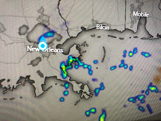
This is a quick morning update. NHC has increased the chances for development of the system over the Bahamas (Now 96L) from 50 to 60%. The weaker wave over the Gulf still has a much lower chance to develop (30%), but we are already seeing the increase in moisture as showers are moving in along our coasts.
You don't see many clouds over the Gulf as the daylight views haven't reached there just yet. What the infrered does show is the lack of any storms with this first wave. But look how the clouds have increased east of Florida. That is what NHC now calls 96L and early model runs have begun
As Shelby mentioned this morning..."even if nothing develops and stays just a wave, we're going to see a lot of rain into next week". The new rain predictions for the next 7 days show that.
We still are in the 3-5"+ range, but note there is an area just to our east of 10"+ amounts. I think for that to happen is 96L becomes a weak depression that slowly crawls along the northern Gulf . No this is NOT a Harvey scenario as that storm dumped 50+" over Houston. However, 5-10" here could begin to cause some issues. We'll need to see what, if anything evolves with 96L. The next question is...Where will Sally form?
Well yesterday I thought it HAD to be the system coming off of Africa and NHC does give that disturbance a 90% chance (It's gonna happen) to develop. But look at its structure on satellite views this morning compared to the the clouds east of Florida. Humm...which one looks ready to become Sally? Next update late morning or this afternoon. Stay tuned!


2 comments:
Thanks Bob, appreciate the insight.
I visit your blog every day.
Post a Comment