Above is the upper air chart for Tuesday morning showing a big dip (East Coast Trough) in the steering that will drive a real cold front down into the Gulf. No it won't get you running for the heavy coats, but we might need some sweaters/light jackets by Wednesday morning. The timing has changed slightly with the front now expected to arrive on Tuesday instead of on Wednesday.
So let's start by looking for some cooler air. On the surface map are several fronts, but none are the real deal. What's left of Beta now NW of Birmingham and the weak fronts rotating around it have brought us drier surface air. higher up, the moisture lingers as an extensive cloud deck goes back into Texas.
It may take another day for the clouds to break up, but no rain is expected. The biggest impact now are the falling high water levels as winds and seas have decreased, plus the wind direction shifted to the west pushing water out of the Lake & marshes.
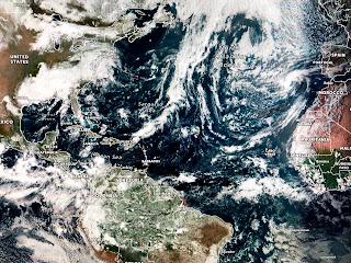
The best news is none of the computer models are finding any tropical development for the next 10-14 days.
That is not surprising since the MJO has jumped into the unfavorable (sinking air) phase over the MDR. We'll need to pay close attention to the western Caribbean & southern Gulf for development closer to home. Once that front pushes into the Gulf late next week, I'll be watching to see if any spin up tries to form. Until then, enjoy the Quiet. Stay tuned!


No comments:
Post a Comment