


Radar views tell the same story.


On top is Laura with a well defined wide eye wall while the 2 below are Delta's ill-defined eye structure. What made the difference? 6 weeks & a change in seasons that brought us 3 significant cold fronts that dropped the oceanic heat content over the northern Gulf way below late August. This is not to minimize Delta's strength. I was out in my backyard and we easily had wind gusts to 40+ and look how far away we are from Delta's center! Later tonight, when the tail end of Delta swings through, we could see more gusts to 40-50 mph along with briefly heavy rains. There might even be a tornado watch issued for us? All that will be gone before daybreak. OK, it's in the 4 PM advisory and it has no surprises.


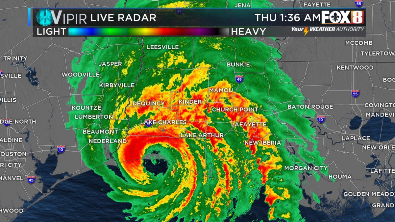
NHC indicates Delta is beginning to accelerate to the NNE at 14 mph with winds now down to 105 mph at best. The northern eye wall is moving inland with the center less than 30 miles from the coast. It should make landfall in 2-3 hours making it the 10th landfalling storm on the U.S. coast line, a new record. Zack Fradella had a nice graphic showing that on FOX 8 at noon.


Of course with every record is some question in the validity of the numbers. For example, look at Tropical Storm Marco that NHC claims nipped the LA. coast. Humm, it had no weather with it at the time, yet it goes into the books as a landfalling named storm.


The bottom pic shows the storm surge overtopping the land south of Abbeville. That will be where the highest storm surge occurs. All in all, another near miss for us. So before anything else pops up in the Caribbean & southern Gulf, let's get those cold fronts coming.


Alas, the next front on Tuesday will bring some drier air sweeping away the tropical moistures/70+ dew points from Delta, but it will have very little cool air. A stronger front should come by NEXT weekend. Until then, we sweat some more.

9 comments:
As always, thanks for your insights and the comparative graphics. Hope thing calm down now, (if only on the weather front)!
Bob Breck has turned out to be correct,in regard to the storm becoming weaker and not presenting the same level of danger as Laura.
Always brilliant and calming when need be. I can say enough about how I feel for the folks dealing with this storm right now. You saved my tail (and my family) during Katrina (I waited along with you to see that turn that never came) but I knew when you said it was over and we needed to move quickly, we did! HOWEVER, and what's more important to me, in many ways, you always are able to be calm and use the science and knowledge you have and KEEP PEOPLE FROM UNNEEDED PANIC!!! That's what drives me crazy about so many other folks in your field...they always have storms 'going up the mouth of the mississippi' and they start to fan the panic so viewers continue to view.
I believe that weather forecasting, despite all the satellite information and computer models, is still a work in progress. Over the years I have come to realize that any forecast beyond 48 hours is an educated guess. In addition, I am in my 60’s, and I can tell you weather patterns have changed since 40 years ago. So, don’t blame the messengers. It’s not their fault!
TY Bob!! I'm wondering where our anonymous weatherman is tonight? The Crazy Ivan didn't happen, perhaps he should stick to watching The Hunt for the Red October instead of bashing Mr.Bob. Thanks again Bob.
I Echo others in thanking you for your calm and great insight to our crazie weather. Happy Belated Birthday 🎂
Ugh he said Katrina was going to be a Florida storm...
No kidding ... good call. PS EVERY storm weakens before landfall as they begin to interact with land. Delta was forecasted to weakens from day one at land fall. Actually Bob turned out to be a BIG failure as he said the Fat Lady sang over a week ago.. next.
Hey Anonymous, show us something, anything, that shows Bob said Katrina would be a Florida (only) storm. BTW Katrina did hit Florida first, but I'm sure you are aware of that.
Just share a link or a YouTube video. Shouldn't be hard for you.
Also Delta did EXACTLY what Bob said it would.
Post a Comment