Now there is disagreement between the 2 main models (GFS & European).
The top graphic is the Euro for Wednesday AM taking the center over Morgan City placing us on the Wet Side of the storm. The bottom pic is the GFS taking the center over Mobile Bay keeping us on the Dry Side of Zeta. NHC has chosen to go with the GFS since the Euro has been wrong on almost every storm this summer including Laura and Delta. Here's the center line trend from NHC.
The top graphic is their initial forecast taking it east of Pt. Sulphur and towards Biloxi. The 2nd view is yesterday's shift back closer to us while the bottom 2 are the latest 10 AM advisory tracks taking it back farther to the east. The longer it stays in the Caribbean with little motion, the better for us as the approaching upper trough later this week will force that turn to the east of us. In fact, I would not be surprised it ends up east of Pensacola/Destin. If that proves true, we'll see no impacts from Zeta aside from some higher tides.
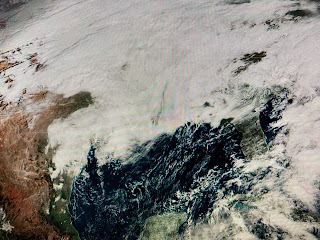
The daylight satellite views show a burst of convection/T-Storms just south of the center with the northern side being almost exposed. I expect Zeta to becoming better organized since it's over the warmest waters of the Caribbean. NHC mentioned the lower/colder Oceanic Heat Content/Energy Potential over the Gulf should weaken Zeta as she heads northward. Look at the difference 3 weeks makes.
The top photo was from Zack Fradella's program 3 weeks ago while the bottom is the current reading. Notice how much colder the Gulf has gotten. Don't be surprised to see Zeta do a rapid intensification process while down over the Caribbean. Then don't be surprised to see a rapid weakening as it heads into cooler waters and increasing upper wind shear. RIGHT NOW, my gut tells me we will be well west of this system with the impacts mainly from Gulfport/Biloxi eastward. This will NOT be like Hurricane Sally with far less storm surge, winds and rainfall.
Locally, lots of cold air clouds cover much of the nation, and I do mean cold air (Denver 14!).. It feels damp outside since the temperature/dew point spread is only 3 degrees. We should enjoy several nice days here with much colder air arriving on Thursday bringing out the heavy weather gear for Friday and next weekend. Now I know that's exactly what many of you want to hear. Next update after 4 PM. Go Saints! Stay tuned!


10 comments:
Good thing that FAT Lady sang several weeks ago and this storm was going over Florida per Bob on Thursday.... oh wait Bob was wrong. (again) Scraped our beach plans.
Hey Karen, the post you are referring to was 4 days ago! Before anything even formed. And Bob was referencing the NHC data that was available at the time. Sounds like you have a bigger problem with the NHC.
Karen B . Yes you are correct while Bob sang "The fat lady" he again this year was incorrect. All he does is report what twc reports. So given that he might want to just stay quiet. The more he speaks the more foolish he appears. It's quite sad to be honest. I mean he has to have family so why do they let him do this to himself?
If he’s so wrong all the time, why are you wasting your time reading his blog?
Go spend time w/YOUR families, if they can stand to be around you.
Thanks Bob! We appreciate your updates!
Yes its interesting to see these same people come here and complain. Why? Maybe mothing better to do than stir the pot!
Not Karen ugh he said it was going east to florida on his Thursday blog. Less than 24hrs later that was not the case. Show me where the NHC said this system was going to develop and go east over Florida? I wait.......
The only reasons why the trolls are here is because Bob is doing a great job!! Hater are just jealous beings!
Hey Anonymous thanks for waiting. If you go back and actually look at the Thursday post you can clearly see the NHC graphic showing where Zeta could form with the area of development/movement going EAST. That's an NHC graphic not something Bob made. Maybe you should pay more attention. Now I wait for your response. HA!
"This system has become much better organized since yesterday, and a tropical depression could form during the next couple of days while the low moves slowly toward the northwest. It has a medium (50 percent) chance of formation during the next 48 hours and a medium (60 percent) chance during the next five days. This system is now anticipated to move near western Cuba this weekend and move slowly across the southeastern Gulf of Mexico by early next week." NHC 23rd 6:50 AM
Please show me where they have the "low" moving across Florida and east as Bob said on the same day. Do you even read NHC discussions or just look at their colored graphics? Slam... next
Post a Comment