


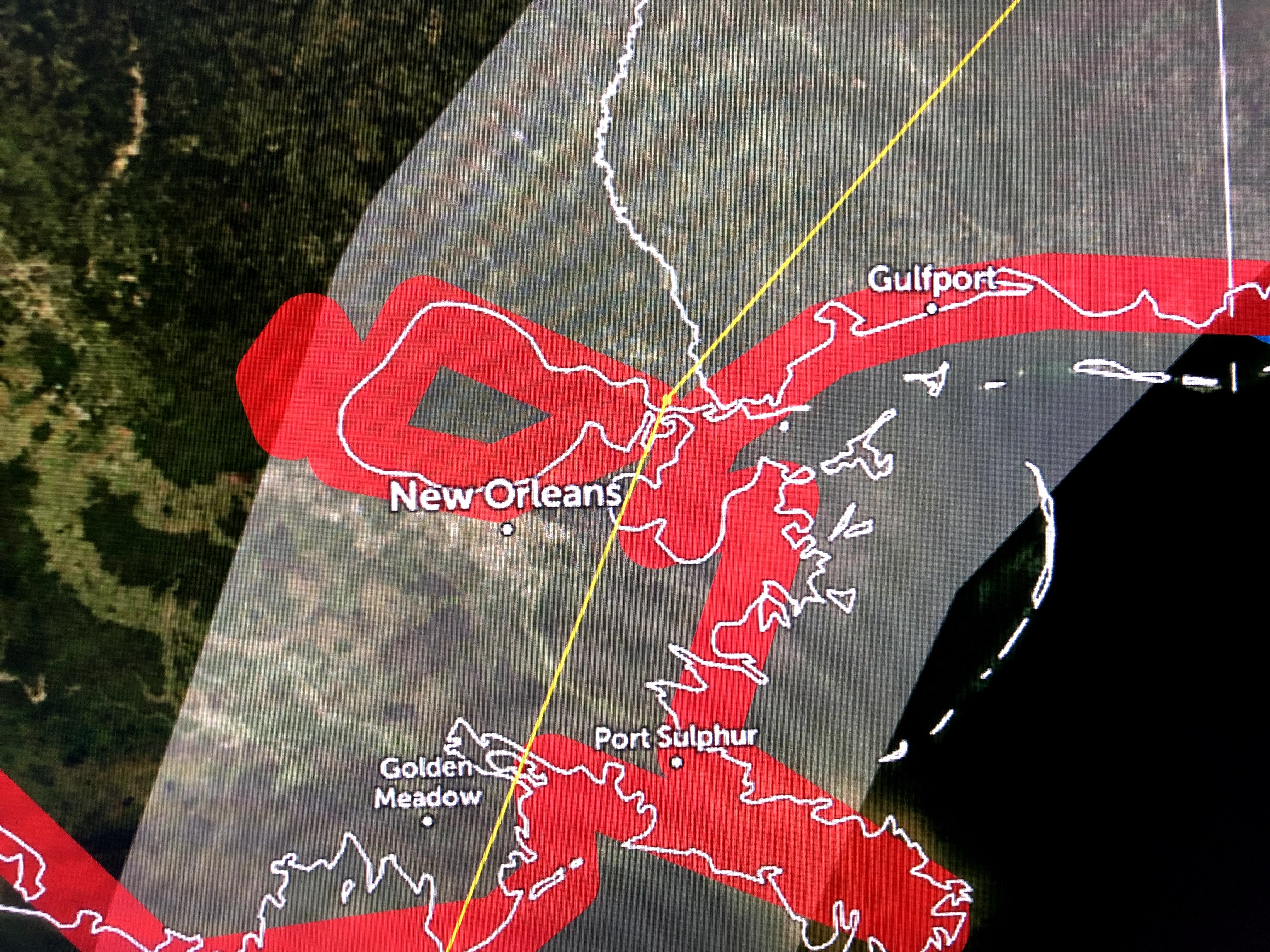

The top graphic is from last night at 10 PM while the bottom is from 4 AM. Notice the shift to the east. Not a great shift, but 20-30 miles will make a HUGE difference in impacts. This will be a good test of following that center line track. My thinking is this shift might continue at 10 AM with the center line going over Port Sulphur and then Gulfport. That's what we in NOLA need. IF you are located to the right of this track, you will get the brunt of Zeta with wind gusts to 80-100 mph causing widespread power outages. IF you live west of the track by 20-30 miles (outside the eye wall), wind speeds will be much less (40-50 mph) with few, if any, power outages and damages. I will feel better if on the 10 am advisory that center line shifts farther to the east. Of course that won't help Plaquemines or the MS/AL coasts where the main impacts will occur. You must be ready for a significant blow, but this will be a fast mover with only 4-6 hours of strongest winds, unlike some past slow moving hurricanes.
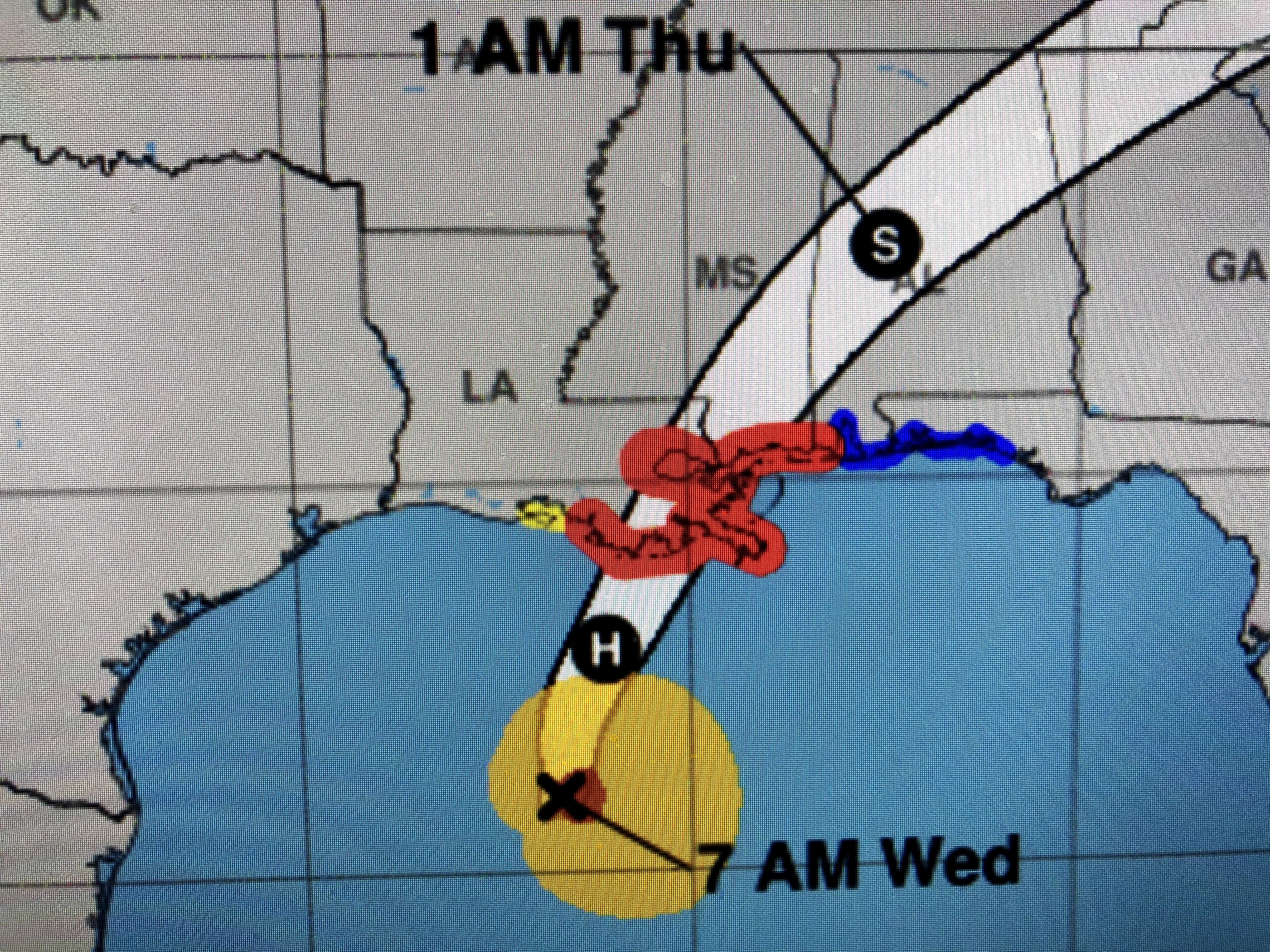


Finally, since the center line track should keep us on the weaker side of Zeta, I'm holding off on going up a ladder to close my Hurricane shutters. That could change on the next advisory at 10 AM. Stay tuned!

17 comments:
very helpful. thanks!
The cold air to the west could begin the weakening process soon, but then again, it might not. Hahaha. Thanks. That's very helpful
Get off that ladder Bob and get some automatic or hand-crank shutters....it's the way to go!
Actually Unknown, he didn't say that. He said that the cold air to the west could begin the weakening process soon, but that because the storm is moving unusually fast, that might not be a factor. I don't know if you're naturally obtuse or you just enjoy being deliberately dense.
Thanks, Bob, for your usual reasonable analysis. I'm so tired of the sensationalism, even with some "professional" meteorologists.
thanks bob- your always the expert i listen to
Thank you Bob! Your services are greatly appreciated, always!
Hopefully it will stay the course and come straight at us. I’m very excited!
Hurricane lover
I live in Metairie. What general area do you live in? I am trying to determine how close I am to you, if you decide to close your storm shutters, I will consider other precautions, as well.
You must be a total troll just coming here to rattle people. Otherwise what kind of an a-hole hopes for a hurricane to strike a city/area that can barely stay afloat. You need to GTFO.
I don't see that much of a significant turn eastward now in time, plus Fox 8 is saying the storm looks like west side of the storm is the worst quadrant.
Nothing excites more than to see people like you freak out because of a hurricane!
Hurricane lover
Bob? Do you have an update?
Dearest Anonymous,
Your sarcasm, ignorance and mean spirit is noted. If anything, it proves there's a village missing his idiot today. Please return home soon and find someone else to annoy.
Hurricane Zeta
Hurricanes are dangerous weather events for many of us in South Louisiana and along the gulf coast. Bob is kind enough to give us this information just because he's a nice guy. Thanks Bob on behalf of the thousands and thousands of people on the gulf coast for your continued meteorological advisories that help to keep us safe.
North and west side of the storm is the strongest quadrant currently , don't need an expert for that just look at the radar with your own two eyes . It will wobble back and forth so it depends on what wobble it is on when hit passes over us on will decide the destructive capacity. Again right now Fox 8 showing radar and verbalizing the north and west side of this storm is the strongest .
What is the closest, yet far enough to get away from hurricane winds Is BR far enough or maybe Lafayette ?? Thks
I second that!!
Post a Comment