Today was another beautiful January day with plenty of sunshine and highs 70+. However, if computer models are accurate, the South will get a soaking while the North increases their snowpack.
The top graphic shows a swath of 3-4" rainfall across Louisiana into Mississippi with 1-2" over the North Shore and less than an inch south of Lake P. Farther to the north where it will be cold enough, several snowstorms could leave behind several FEET of the white stuff.
The top graphic has the heaviest (2'+) across Iowa into southern Wisconsin. The next indicates double digit snowfall will spread all the way to the East Coast. The bottom graphic shows today's snow cover (see the outline of the Rivers) on the Satellite view. Note there is no ice on southern Lake Michigan. In fact, TWC said only 1% of the 5 Great Lakes are ice covered. That shows how mild a Winter it's been so far.
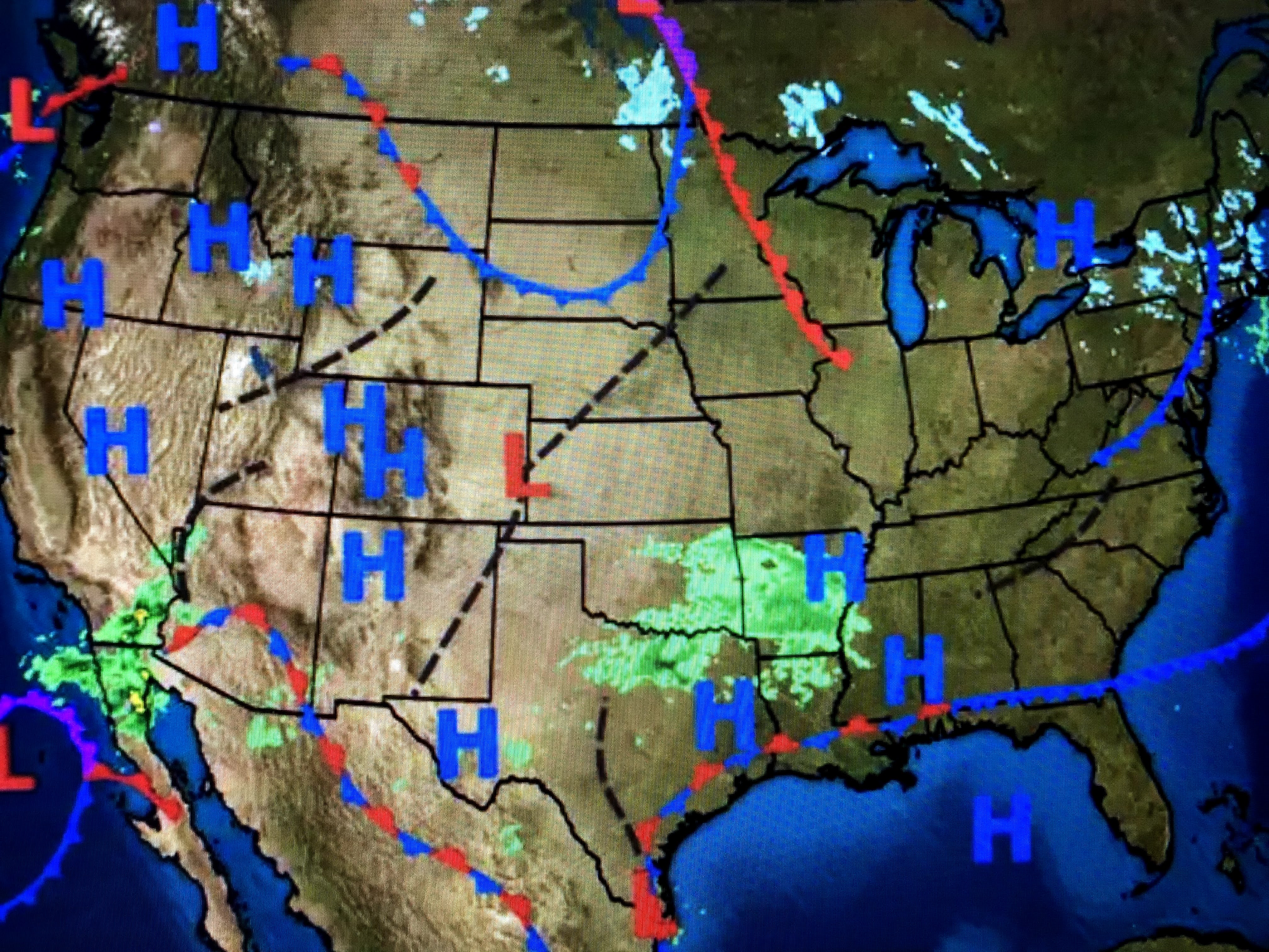
Satellite views have a plume of clouds spreading northward out of the Gulf. The upper low off the California will be the trigger for the southern rains her late Thursday into Friday.
The only locations seasonally cold are the Great Lakes to New England. All of the Arctic super cold remains well north up in Canada with no signs of that coming southward for the rest of this month. What I am see is the higher dew points approaching 60 that will cause sea fog along our coast for the next couple of days.
The clouds around SE LA/MS are not fog. Look to the SW of Morgan City. All of that is sea fog.
Checking my yard this morning and I noticed my lawn & garden could use a soaking. Looking at the 7 day, we have 2 opportunities coming on Friday and then again on Monday. All my potted plants are staying outside to soak up the rainfall. We will see a brief cool down on Saturday, but it will not be drastic. Hope you have been able to get out and enjoy this "January Thaw" as it should last into early February. Stay tuned!


No comments:
Post a Comment