The pink in the top graphic represents wind chill advisories with the white being the Winter Weather Advisories. The close up view shows how parts of the FOX 8 viewing area is now included.
I noticed that subtle shift from last night to this morning. The top 3 graphics I grabbed from Bruce Katz last night with the bottom view from Zack Fradella this morning. Look closely at the slight shift between the top (last night) and the bottom (this morning). This will be a close call for SE LA/MS. One thing for sure, do not plan to travel west or north on Monday or Tuesday.
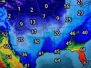
The other main story will be the intensity of the cold air here Tuesday morning. RIGHT NOW, the North Shore is likely to see a hard freeze (15-20 degrees) for many hours with the South Shore a light to moderate (24-280 freeze. I would suggest you protect all your tender plants on Sunday and almost everyone will need to trickle the water for Monday night into Tuesday.
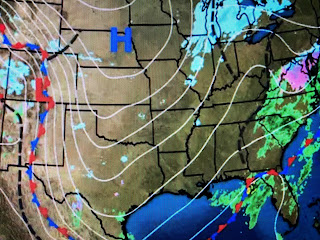
As is typical of Winter time, clouds cover most of the country. The large, Polar high is centered over Nebraska with one weak storm moving off the East Coast with the stronger second system coming out of the Rockies. There is yet a third storm off the West Coast that will follow for later next week.
Sunshine has been hard to come by this week, but where it breaks out (like Houma), temperatures bounce up to 50+. I am not complaining about the cold as it feels refreshing IF you're dress for it. When I walk Bailey, she seems to really enjoy it since she has so much fur.
I found these pictures the last time we had some snow back in January of 2018. Note how she has a very nice fur coat! Stay warm, stay safe & stay tuned!


No comments:
Post a Comment