Temps. along the North slope are 40-45 below zero and all it would take for some of that chill to head southward is an East coast upper trough.
The top graphic is today's upper flow with the trough over the Rockies. The middle is valid for March 7th showing a digging East Coast trough. That will mean another serious bout of Winter chill is coming back into the U.S. during the first week in March, It will not be as bad as 2 weeks ago, but don't put those sweaters and coats away just yet. The bottom graphic is valid 2 weeks from now with the trough back out west which should result in us getting warm again.
For the next 2 days we'll stay in the warm air sector with lots of low level moisture resulting in daily morning clouds and low clouds. That front will sink our way on Tuesday bringing us some showers and cooler temperatures.
Notice how each day looks to have lots of clouds so sunshine will be at a premium for the next 7 days.
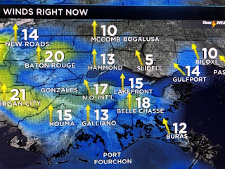
Winds are again brisk this afternoon and that could help keep tomorrow morning's fog up off the ground as a low cloud deck. High temperatures are supposed to be around 70 , but this afternoon we're well above that.


No comments:
Post a Comment