


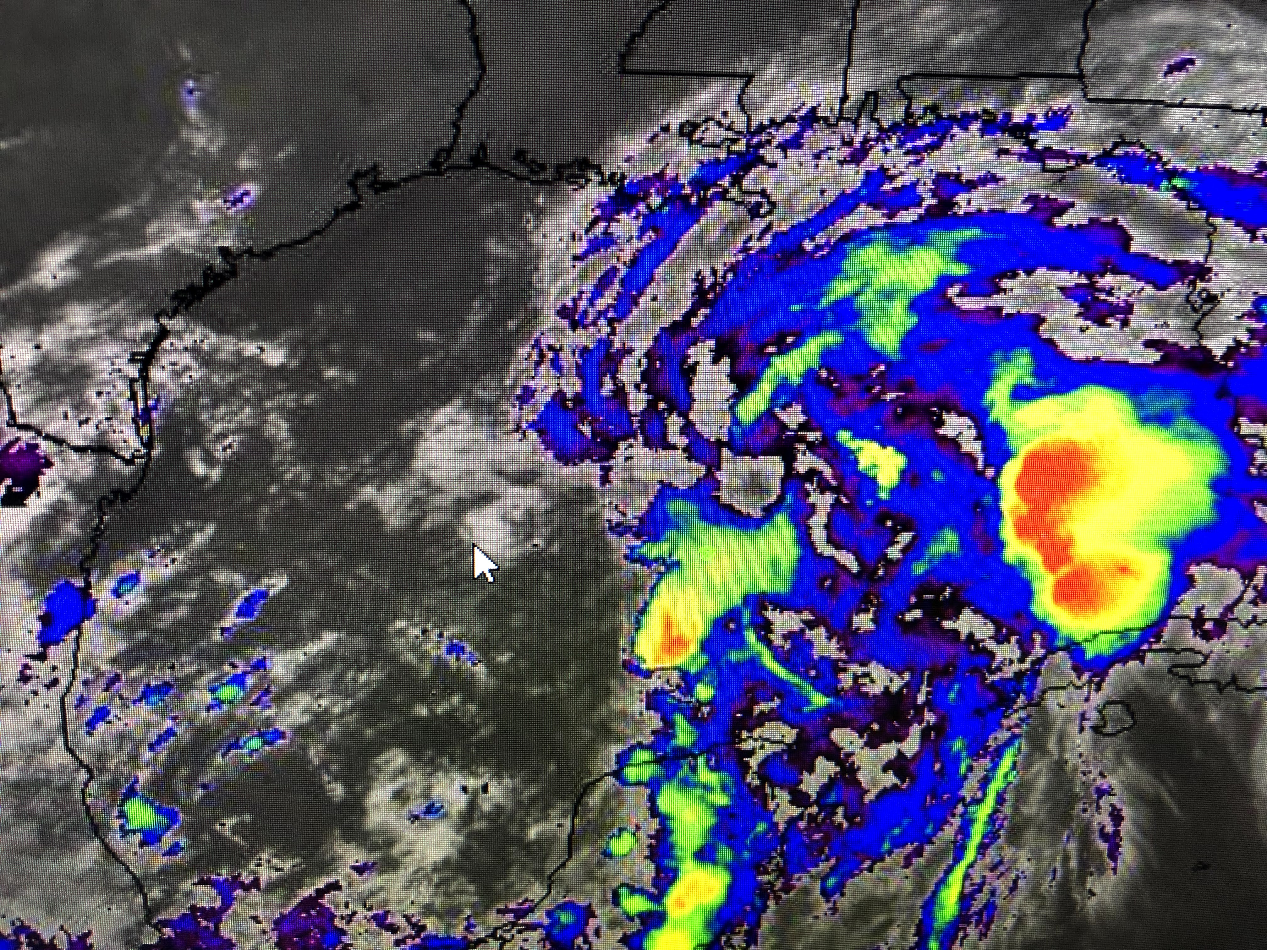
NHC continues to project an area of low pressure will close off and intensify into Tropical Storm Claudette tomorrow. I'm not sure that will happen. Whatever forms will be a minimal Tropical Storm at best. Their track remains the same from the 4 pm one.


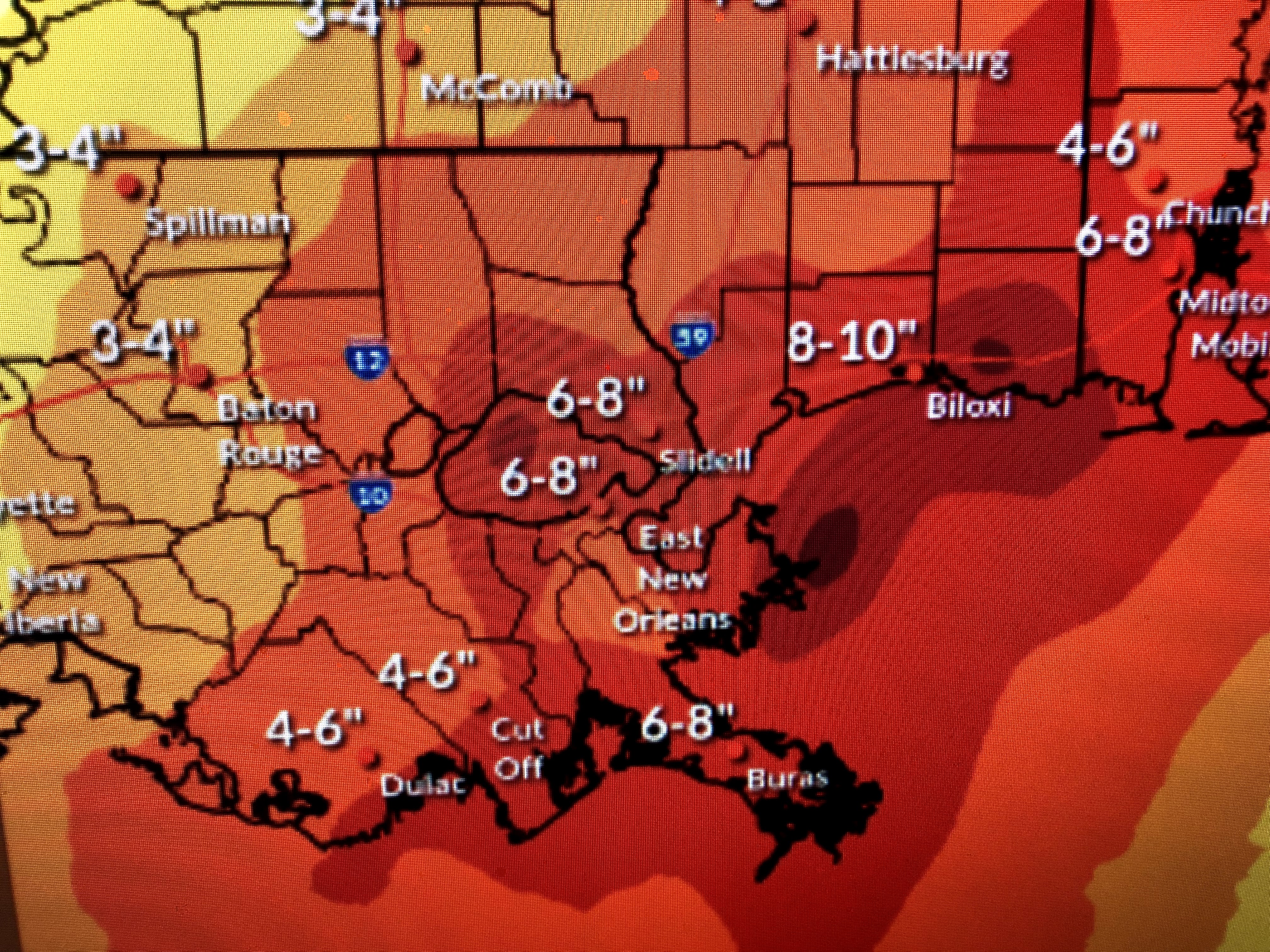
My thinking is more in the 1-3" range with the 3" east of us in Mississippi. Some showers are approaching the coast tonight as surface winds are trying to shift more to the ESE. Since I don't think there will be a well defined center to track, the earlier discussion regarding wind direction becomes less important.


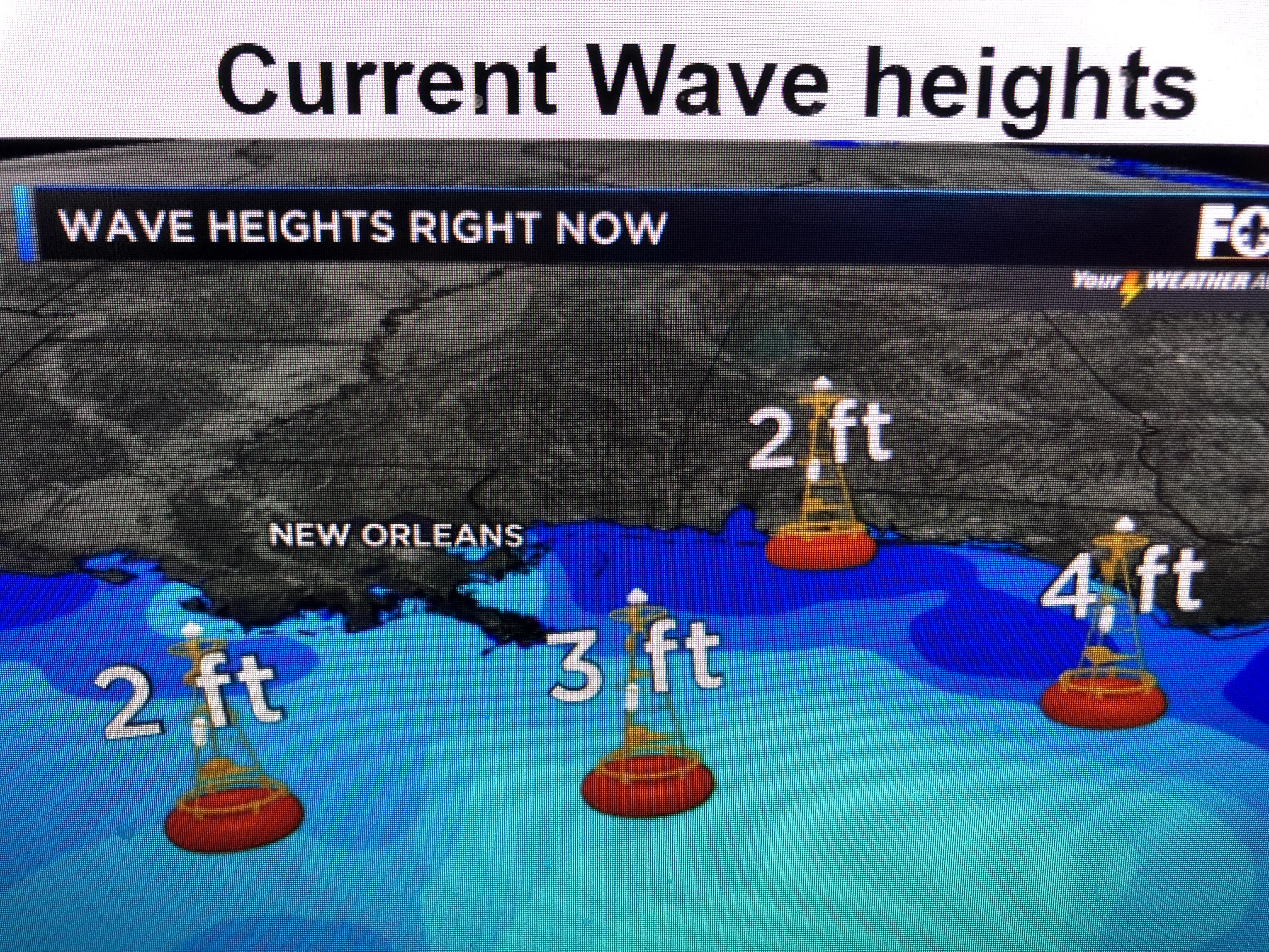
Even the off shore wave heights are not very impressive. Hope you watched David on FOX 8 at 10 PM since his graphics and discussion are what I'm thinking. Whether this system gets a name or not, it will not become a strong storm. If you're inside the levees you have little concern tonight. There could be some high water outside the levees, but it should not be a big deal. I'll try to post several times tomorrow. The less I post mean very little new information. Stay tuned!

2 comments:
thanks
Thanks Bob!
Post a Comment