NHC still hasn't named TC # 3 Claudette despite indicating sustained winds are now 45 mph. I think the problem remains that the Hurricane Hunters cannot find one closed off center. I've placed an L where it appears to be a low level center, but the radar loop has multiple swirls.
Two things are very obvious. 1) All the weather/storms are displaced well east of the center and 2) the northward surge of radar echoes clearly takes most of the rain east of NOLA.. In fact, look at where all the lightning is occurring down over the Gulf.
It's east of the mouth of the River and that's where the bullseye for heaviest rains are aimed. IF that trend continues, Metro NOLA will receive 1-2" of rain at most with the flood threat being east of the Pearl River especially towards Mobile Bay. NHC's forecast (not really meaningful with such a weak storm) continues to shift farther to the east on each advisory.
Last night the centerline track was west of Morgan City with this morning's track between M.C. and Houma. The latest now has it east of Houma. That's centerline isn't that important with this disturbance as most of the weather is displaced far to the east of the center much like Marco in 2020.
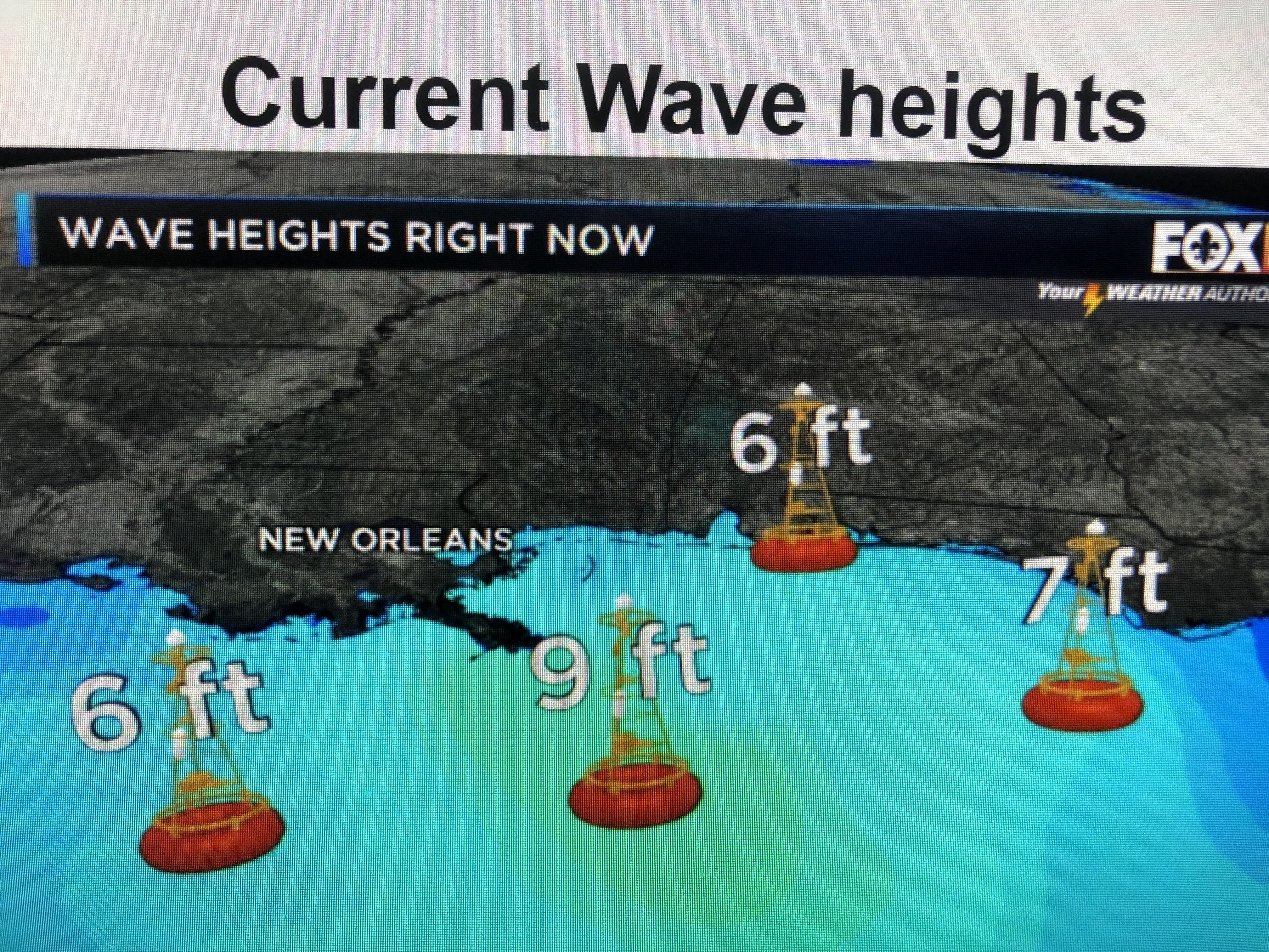
Surface winds have increased, but the direction hasn't shifted yet. Based on the increasing wave heights, I suspect NHC will finally name TC # 3 Tropical Storm Claudette in the 4 PM advisory. If they don't, then maybe it will stay just an open wave as it moves inland overnight. I'll post again after 4 PM. Right now I'm thinking we'll see winds 20-30 with gusts to 40 later this afternoon and rainfall in the city 1-2" at most with more down to our south and along the MS/AL coasts to our east. Stay tuned!


No comments:
Post a Comment