It's the same story on the 10 PM NHC advisory. TC # 3 has not been upgraded to Trop. Storm Claudette as there remain multiple swirls but no well defined closed center. In addition, all of the heavy rains/storms are far displaced from the low level swirls indicating that it's unlikely this system will be our next named storm.
The North Shore and the Mississippi coast are still getting the tropical heavy rainfall, but it's mostly over for those of us on the South Shore with Plaquemines & St. Bernard being the exception. The ill defined center is just south of Port Fourchon and will be inland after midnight.
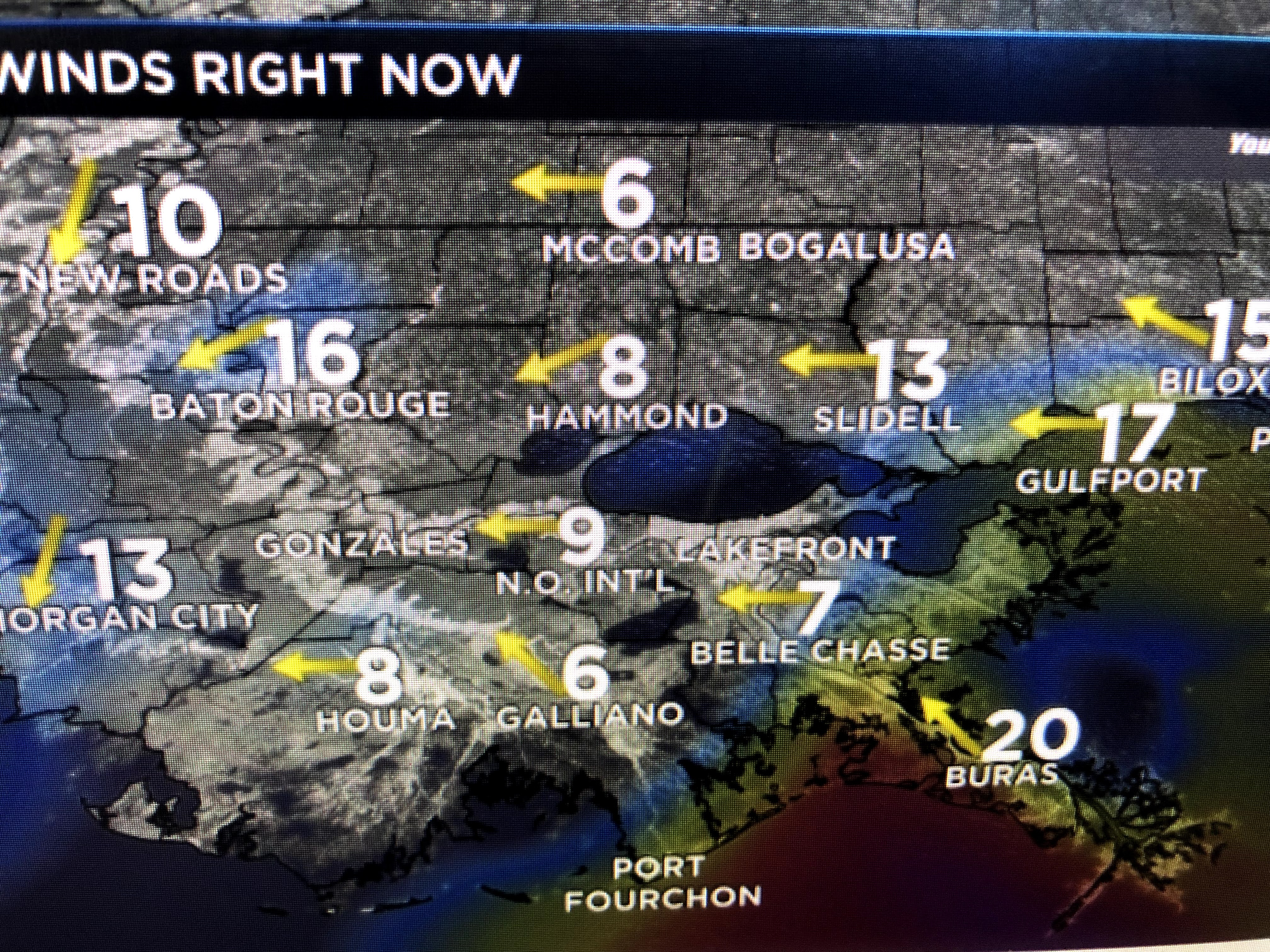
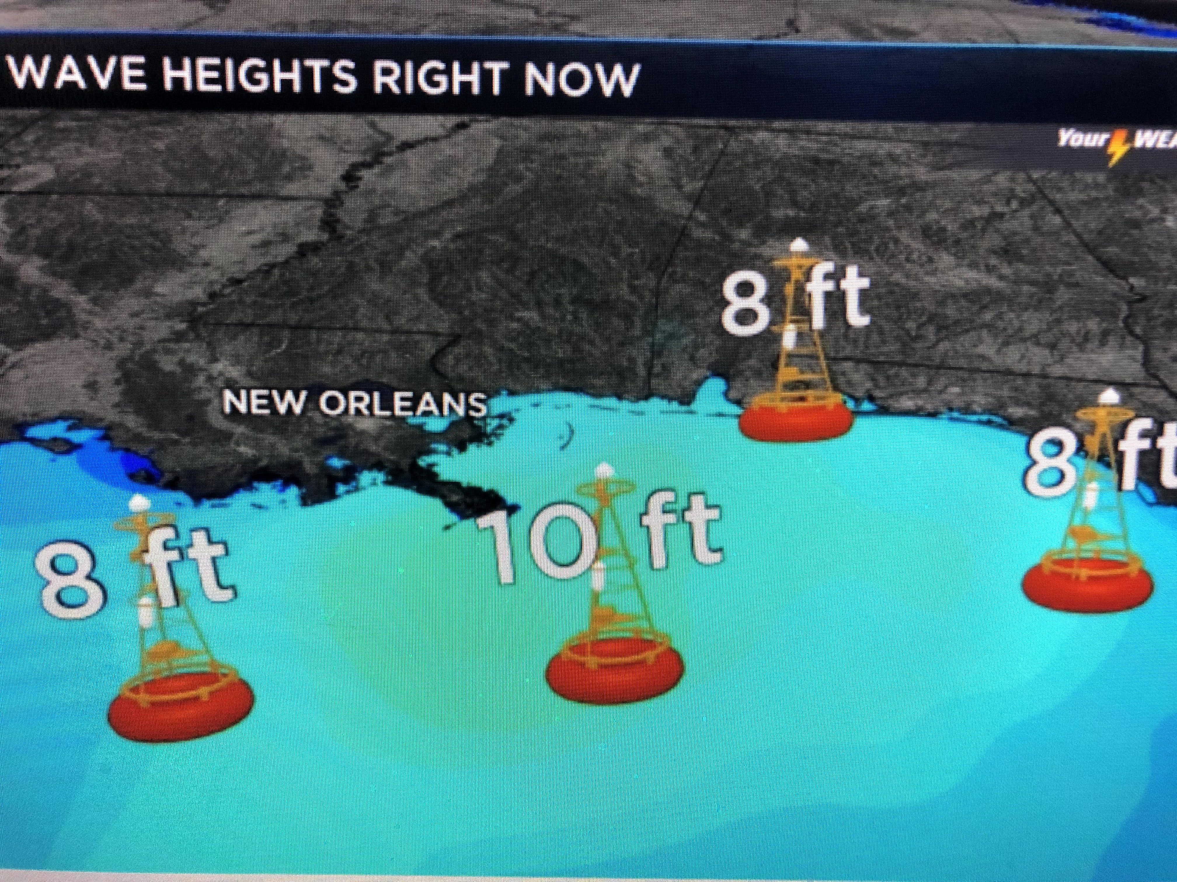
Note the wind direction at Morgan City has shifted to the north indicating the center will move east of them. Wave heights have not started to decrease and boaters need to stay in protected waters again tomorrow. The new rain total forecast tells the tale.
The 6-10" bullseye has shifted from Gulfport eastward to the Florida beaches. The surface map has no closed isobar (lines of equal pressure) around this low and it would be a shame if, at this late hour, it is given a name.
Tomorrow & Sunday should be brighter days with fewer showers and hotter temps. Enjoy your weekend and stay tuned!


1 comment:
Hi Bob- We are in Slidell on Bayou Liberty and Bayou Liberty water gage height is 6 foot and rising at 5am. Water has completely covered the streets. Yesterday NHCnoaa predicted 1-2 feet tides above normal and I just checked it and it says 2-3 feet above normal now. Before Katrina there was a few trees between us and the lake and now you can see the lake plainly in the daytime from the 2nd story. Staying high and dry--
Post a Comment