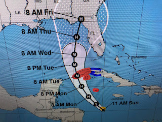
Tropical Storm Ian is getting better organized on satellite view, but he is NOT intensifying yet. Notice how his past track motion shifted over night, going from WSW to W and now to the NW. That is great news for Louisiana, Mississippi & Alabama. The spaghetti models haven't continued the westward shift, and in fact have clustered on the Great Bend of North Florida.
The 2 main global models remain far apart on where landfall will occur and this will require NHC to over warn coastal locations. Here's why. We start with the European.
The Euro model has been consistent on taking Ian into/near Tampa/St. Pete. If it proves correct, this will be a big blow for Florida's west coast. I advised my friends in Tampa (Tom & Susan) yesterday to get to Costco & stock up.; You still have time to do that. However, look at the middle & bottom graphic. That is the GFS solution that has it well offshore from Tampa on Wednesday and not making landfall until Friday east of Apalachicola. yesterday is had landfall at Pensacola. OK, IF the GFS proves correct, the Tampa Bay region would miss the eyewall and the worst of the storm surge. But gee, that's a close call. Predictably, NHC has chosen to split the difference.
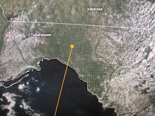
The center line track takes it into an area of the coast that has far fewer people & property at risk. That is the good news. The bad news is wherever landfall is, the impacts will be severe.
So far, Ian is still struggling to get stronger as you can see the lack of organization on the color IR view.
All signs point for that to change and here's why.
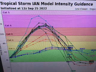
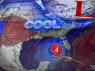
The top 2 graphics are the ocean heat content showing the deepest, warmest waters. The arrow points to Ian's location which is about to reach the warmest waters. Without the upper shear from Fiona around anymore, most hurricane models call for rapid intensification beginning this afternoon. NHC is calling for a CAT. 4 (130+) west of Tampa weakening as the storm goes farther to the north. By then, upper shear from an East coast trough, plus drier air from a cold front will impact Ian.


1 comment:
Thank You for your insight, Bob. Please keep doing what you do.
Post a Comment