The top graphic was taken from a story about "was Louisiana becoming a magnet for major hurricanes?" It tried to convince us that since 2005, we have been hit 5 times and are likely to see more this year. The next 3 views are from the NHC's preliminary recap of what really happened. Note, aside from Ian moving into Florida, the northern Gulf had zero threats this year. It's always about location and the experts do not have that kind of skill to forecast in advance. Let's just be thankful we were quiet this year.
Before I get into today's weather, let me rant about the use & abuse of the water vapor loop. First you must understand the water vapor shows atmospheric moisture at 10-20,000' above the ground. I watched a local weathercaster place cooler & drier over us on the WV loop and say, "you can see the cooler & drier air moving in". Huh? Water Vapor does not always mean drier at the surface. In fact, these views were from 3 PM and the drier air already was moving out with upper level moisture streaking in from the SW. in addition, watch and see weathercasters zoomed way in when the real purpose of this loop should be to show the upper flow over a wider view as I drew on the visible loop. (bottom graphic) I wonder who is mentoring these younger meteorologists? Nuff said.
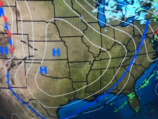
Today quickly turned sunny as last night's cold front (blue arrows) pushed down into the Gulf. Brisk north winds brought the cooler & drier air southward as a large surface high built in.
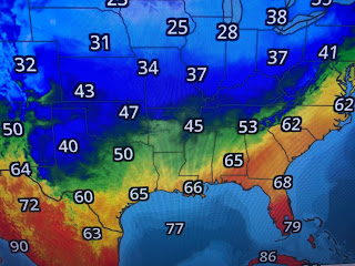
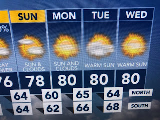
the core of the cold will stay to our north as the upper flow from the WSW will prevent to real chill from coming our way. Look at how low the dew points (bottom graphic) are. After Thursday's pleasant feel, a warm up returns Friday into next week.
Until the upper trough over the western states reforms over the Great Lakes & east coast, we'll stay spring-like for the next 7-10+ days.


No comments:
Post a Comment