


When we had the bitter cold, there was a deep dip in the upper flow over the eastern states. Right now we have a very fast & progressive pattern that is mainly west to east with no real dip for us. That brings in milder pacific air to the nation. The bottom view has more storms lined up out over the Pacific with no change in the pattern coming for awhile. That should result in above normal/average temperatures with no freeze threats. Historically, we are about to enter the coldest 2-3 weeks of the year. The higher sun angle & longer days won't start to show up until well into February or early March.


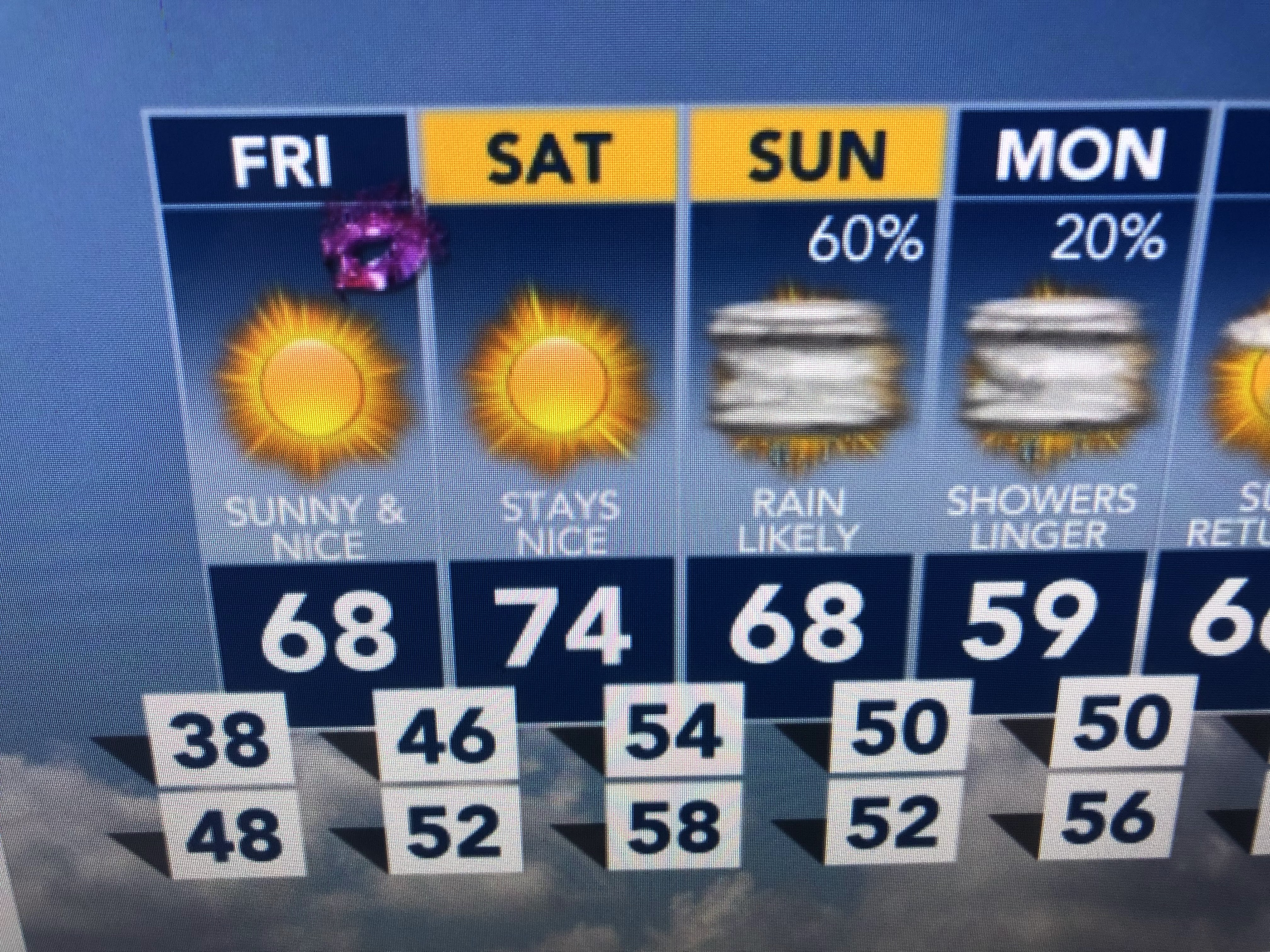
Gosh, can our weather get much better? We hit 70 again today after yesterday's 77. The "bomb cyclone" that slammed into California is NOT coming our way. There may be a weak front on Sunday, but the main energy of that system will stay far north.


As our winds shift back off the Gulf by Saturday, we'll see the muggies return with some showers on Sunday.


If you enjoy the cold & snow, you'll have to fly out West of go far to our north. I'm already seeing some new growth coming out of the ground with these warmer temps.


Finally, with all the rains & melting snows farther north, a surge is coming down the Mississippi that will get the River level above 7 feet in 2 weeks. If these Pacific storms keep marching across the country, we'll see higher river levels as we head towards Spring. Stay tuned!

No comments:
Post a Comment