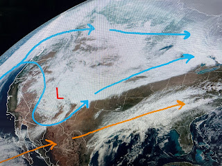
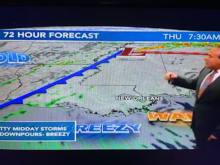
As the bottom graphic indicates, the greater risk for severe storms are north of Lake P. onward into MS/AL. That would be good news for tomorrow night's parades. Bruce timed out the arrival of showers tomorrow night.
If the computer timing is correct, the bulk of the rain will stay north of Lake Pontchartrain.
Look at how old it is under the western upper trough. The core of that cold will stay to our north, but the cool down for Friday & Saturday will bring back the sweaters & heavy coats here.
The detailed parade forecast has late Thursday with the best rain chances with Monday & Tuesday with only a 20% chance. The coldest day & night will be on Friday, but Saturday will see only a slow warming.
Finally, the snow storm coming out of the Rockies is bringing much needed moisture to areas under the worst drought conditions. Not all the weather news is bad. In fact, more rain is coming back to California during the next 10-14 days. Stay tuned!


No comments:
Post a Comment