Surprisingly, the records were set with no snow cover on the ground. Remember, most of January has been very mild over the Northeast with temperatures too warm for snow. But changes are coming.
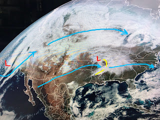
The upper flow is back to west/southwest cutting off the cold air for now and allowing much warm air to surge northward. Our next storm is bringing rain back to California. That system will approach us late Wednesday and, if computer models are correct, will deepen the upper trough over the East bringing a freeze threat for us NEXT weekend.
The good news is parade weather would be dry for Friday through Sunday. The bad news is highs (at best) would be 50-55 with nights in the 30s. Burrr!
In the short term, a weak upper disturbance is moving to our north with some clouds, but that system will race away leaving more sunshine for Sunday. As winds shift back off the Gulf next week, clouds will return along with warmer temperatures.
I'm concerned the FOX 8 forecast for next weekend is not cold enough IF the computer guidance proves accurate. Finally...
The recent rains & snow melt has sent a rise down the Mississippi River that will approach 10 feet next week. No big deal yet, but if we see future heavy Spring rains up north, we might have to worry about high water in late April to early May that might prompt the Corps to think about opening the Spillway again. Hope not. Stay tuned!


No comments:
Post a Comment