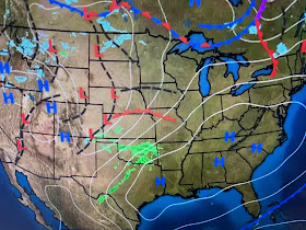
It's above freezing in Minneapolis, Green Bay, Detroit & Buffalo. So what about that Polar Vortex during the next 10 days?
The top graphic is from this morning with the middle valid for Fat Tuesday & the bottom valid for next Saturday. The vortex stays north with the Rockies trough reforming. That means it'll continue to be mild to warm over most of the Southeast.
There is a weak upper feature causing some clouds & light rain to our north, but that will pull away on Sunday.
I love to point out features on satellite loops. This afternoon's visible view has the easterly low level flow (yellow arrows) with the low level moisture (green arrow) over the western Gulf. On top of that, we have the sub-tropical jet stream (orange arrow) coming in from the SW. Neat stuff. Note winds have decreased so tonight will be another chilly night. I'm leaving my plants out but will look at the temps at 10 PM to decide if I need to bring them in.
Yeah, I know Mardi Gras is not on Wednesday. Operator error! Enjoy the parades (Endymion on FOX 8 beginning at 8 PM) and stay tuned!


No comments:
Post a Comment