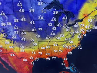
What that means is the northern tier of states remain chilly with the southern states just comfy.
Look at the difference between those in sunny skies & those with clouds. In addition, dew points have lowered into the 30s & 40s making for good feeling air expect in extreme south Texas & south Florida.
A weak upper system will increase our clouds for Sunday PM, but rain chances will stay near zero with the dry surface air. Another upper disturbance will bring our next rain chance late Tuesday into Wednesday.
Finally, with clear skies, I always like to look for clear water for fishing. The view from space still finds lots of muddy waters. However, my neighbor's brother caught his limit on a charter captain trip out of Shell Beach.
With the winds staying up for the next 2-3 days, finding clean water will be difficult. Stay tuned!


No comments:
Post a Comment