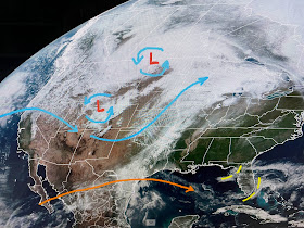
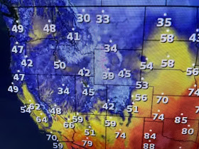
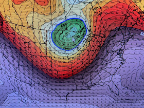
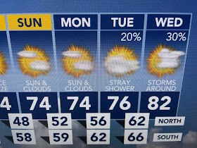
The top is valid this morning followed by valid Friday, Saturday & Sunday mornings. The surface cold front should easily pass through late Friday, but the core of the cooler air will stay well north. We'll end up with comfy, cool less humid air that will have us feeling great!
So in the short term, Thursday looks to be dry, breezy becoming more humid as highs top 80+.
Dew points (bottom graphic) are still low, but note the 60s & 70s back in Texas. You can see the moisture return on satellite views.
The warmer temps are well inland from the cooler Gulf waters which are still mainly in the high 60s & lower 70s.
Satellite views also show several wild fires (orange arrows) in Louisiana & especially in Alabama. We had a good soaker last weekend and could use more with this next front. Not sure if it'll produce the widespread rains like the last front. Finally, as they say in sports...AFTER FURTHER REVIEW, I looked back at my harsh comments yesterday and would like to apologize to our local weathercasters. Many of them I consider good friends & only wanted to point out a trend I'm seeing around the country. Were are fortunate to have some really good meteorologists. I needed to rant and should have considered less harsh wording. Still, we want more than weather reporters who just show models. Tell me what you think &, more importantly, WHY. Peace! Stay tuned!


No comments:
Post a Comment