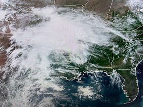
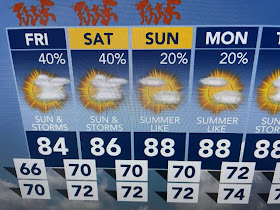
Looking at the upper pattern, one would think our weather should be mainly dry for Friday/Jazz Fest. Not so fast weather breath! The deep trough over the eastern states has lifted out as the western upper low slides into California. In between, there is an upper ridge that should inhibit storm formation except where the jet streams split (green area)
So with us under the upper ridge, we should stay dry with the storms passing north of us right? Well look what the model shows for Friday PM.
Nicondra showed us a line of heavy storms developing across the North Shore sliding down to the South Shore late in the day. How can that be? I don't know. perhaps the models see something I don't. Whatever, I'd be prepared for rain if you're going out to the Fest.
Tonight will be another nice night before the muggies invade (70+ dew points in Texas) tomorrow PM.
We are nearing the time of the year where every day will have some kind of rain chance due to daytime heating. As fronts stop coming, the 7 day becomes almost useless. I do think we have another weak front for late next week. Until then, get use to summer. Stay tuned!


No comments:
Post a Comment