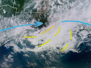
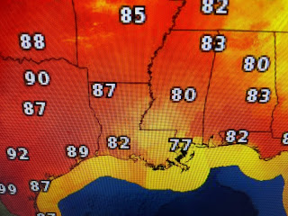
I would have NEVER expected an all day dumper based on satellite & radar. But the models saw something &had several rounds of heavy storms. The yellow lines on the satellite view are where I see these weak boundaries that I talked about yesterday. Note the difference in temps with sunshine heating north Louisiana up near 90 while we stayed in the 60s & 70s.
As an upper low lifts out of California, that should bump up the ridge over the Gulf South making for more sunshine and few, if any PM storms.
My only concern is yet another weak upper feature triggering more storms over south Texas. They should streak to our north on Sunday. More of us received 1-2" of rain today so we could use several days to dry out.
The big difference you'll notice & feel is the higher temps coupled with the deep tropical moisture. It truly will have a Summer-like feel this week. Enjoy a brighter Sunday! Stay tuned!


No comments:
Post a Comment