On this first day of the 2023 Hurricane Season, there are lots of swirls with clusters of showers from the Carolinas down into the Gulf and farther down across Cuba. Most of the storms with TD # 2 remain off the Florida coastline and lots of dry air continues to flow around the system.
Almost all computer models take this system to the south & then to the east keeping it away from us.
It is not surprising that the official NHC forecast does the same. It's pretty obvious this system will not be a threat to LA/MS even if it becomes a Tropical Storm.
Tonight at 6:30 pm, the annual FOX 8 Hurricane Special, Weathering The Storm will air. Chief Meteorologist Bruce Katz will lead the Weather Team in getting us thinking about what's coming down the road. I'll be watching. In the short term, look for no major changes for us through the weekend.
Summer heat has moved all the way into new England with cooling relief coming under some storms from the Carolinas towards the Rockies.
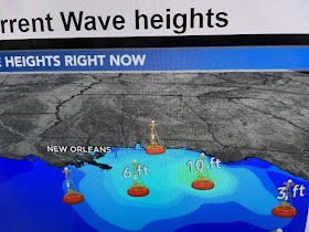
There have been a couple of spotty showers around today, but coverage remains well below average/normal. Note the wave heights east of the mouth of the River!
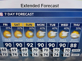
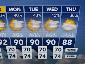
We have reached the time of the year where the 7 day becomes less helpful. It will be hot & humid with daily rain chances, unless we have a tropical threat. Since nobody puts out a hurricane tracking chart anymore (computers plot track automatically), I've partnered with Working Presses, publisher of Inside Northside magazine to produce a Hurricane Storm Guide that provides information you need to know before, during and after a storm.
It will be available within the next 2 weeks and I'll let you know how to pick up your copy. Stay tuned!


No comments:
Post a Comment