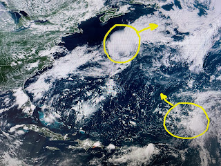
So with the upper East coast trough coupled with the lack of a blocking surface high, all tropical activity is being forced to turn away from the United States. Better yet, none of these disturbances have been developing, a trend that I hope continues well into August.
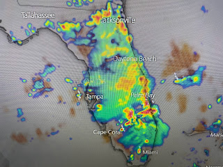
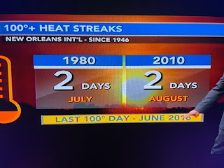
What we need to happen is for the upper heat dome to break down or retreat back to the west allowing for upper lows to move over us like has happened in Florida today. That has allowed widespread showers & T-Storms to develop bringing welcomed relief from the brutal heat. That is not likely here for the next 2-3 days as we could see a stretch of highs 100+, which is a rare event. In fact, it's only happened twice at MSY since 1946.
Our only hope for relief is for a cluster of late PM storms to fire off around the "ring of fire" upper heat dome. That seems unlikely.
However, one such cluster is over Baton Rouge today. The rain has cooled BTR down into the 80s while most of us bake around 100.
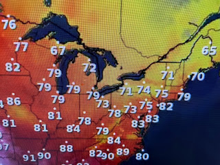
So, despite what the national media keeps over hyping, our nation is NOT on fire. Take a look at current 4 PM temps.
From Minneapolis to Chicago to New York & Boston, it's a comfortable summer day. Same story for most of the big cities out west. Sure it's hot over the southern states, but as a nation, we're not on fire. The real story should be what is causing the lack of the blocking Bermuda High and few, if any, tropical waves coming off of Africa? Too easy just to say "climate change". But wait, it happened in the 1930s, again in 1980 and again in 2010. Could it be a climate CYCLE? Stay tuned!


No comments:
Post a Comment