


Zack pointed out the number of 100+ days (add another for today) with several more to come. Nicondra highlighted the number of record high LOWS.. I know, ya gotta show the temperatures and feels like numbers, but I love it when weathercasters try to keep their audiences interested. What would I be doing? Take a look at what I found.


I subscribe (pay) to Weather Bell Analytics to read what Joe D'Aleo & Joe Bastardi are talking about. They are long time friends & colleagues & I trust their knowledge & experience. Joe Bastardi is my hurricane guru and he recently updated this season's forecast to now include all of the northern Gulf coast (us) in above normal activity. This is based mainly on the way above normal water temperatures of the Caribbean, Gulf & Atlantic. Today NOAA updated their seasonal forecast to go along with the increased activity forecasted by Colorado State.

Geez, that means we need to have 14-15 more named storms during the next 2 months (cold fronts protect us in November). Will that happen? I don't see that. Why?


Here we are 10 days into August and the Saharan dust keeps pouring out over the Atlantic. The dust forecast indicates no let up in the next 7-10 days. No model has any development during that time frame.

In addition, we have at least another week of the blocking upper heat dome over us. So that gets us to August 20th. OK, because of the warm Gulf waters, the threat for us might continue well into October. I'm sure the tropical switch will turn on (always does) for several weeks, but this is a strong El Nino year. I'm comparing it to the 1992 El Nino when major Hurricane Andrew slammed south Florida before coming our way. That year ended with less than 10 named storms & I'm thinking the same might happen this year. We'll see. What else might I show to keep you watching? How about rain in Las Vegas & southern California in August?


We're supposed to get daily storms, but this is not their rainy season. What else?


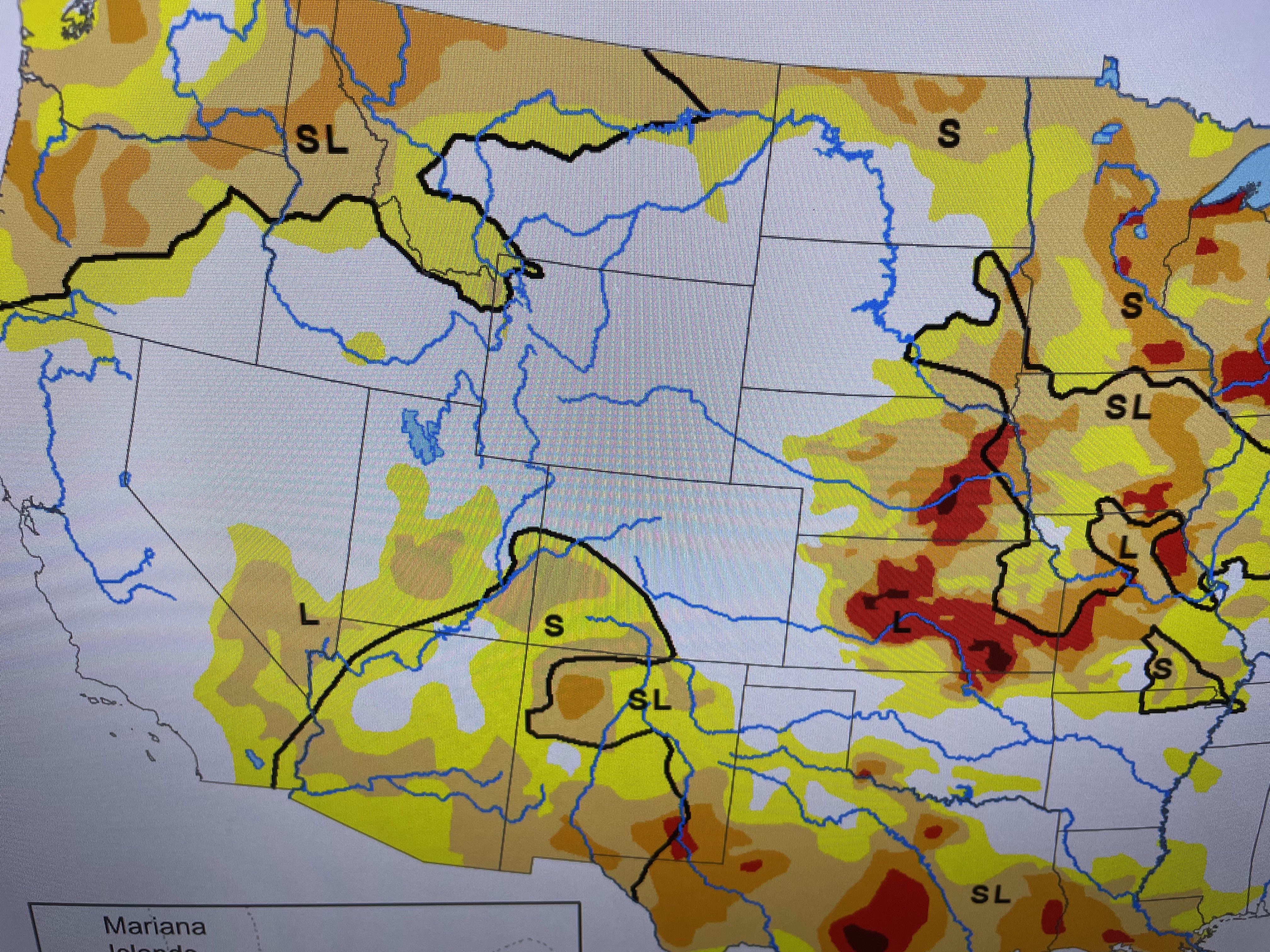
Look at how clear the skies are out West. I could find only 1 smoke plume (orange arrow). The weekly Drought Monitor confirms California is not in drought anymore. In fact, only a few spots in the Plains have exceptional (red color) drought, including parts of LA/TX.


No rain along the northern Gulf (again!) while storms are cooling south Florida. But there's more as lee Zurik often says!


Despite what the network newscasts keep saying, the nation is not on fire. Only the 'extreme" southern states are feeling the excessive heat. It has not been a hot summer over the Great Lakes & Northeast. 70s & 80s would feel nice! But alas, we all know we must get back to the heat.


As you can see, there is no relief in sight until the upper high weakens or shifts away.


It's still there for most of next week. Remember, it does block any Tropical activity from coming our way. I'm just hoping/praying for early season cold fronts to start coming. C'mon October! Stay tuned!

No comments:
Post a Comment