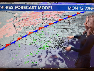
It was a perfect day to complete yard preps ahead of the cold. Brilliant sunshine coupled with near 70 degree warmth made it delightful to be outside. But look at how close the Arctic airmass is.
I always look to San Antonio (28) & Houston (50) to see what's coming our way. It will be a real slap in your face this time tomorrow when you walk outside. The well advertised Polar Vortex is up over eastern Canada setting up a north to south flow straight from the Arctic.
The below zero line has dipped well into the lower 48 with the freeze line deep into south Texas.
The chill isn't moderating since it's moving over a large snow cover. The greatest snow depths, as usual, are in the Rockies, but note how far south the snow cover reaches.
It's so deep over Iowa that the rivers stand out. So the next question becomes "will we see any snow or sleet?" North Shore maybe.
It's the old usual problem, precip. ends before we get cold enough. Coldest morning still looks to be on Wednesday.
Tonight we have no freeze issues so don't start running the water.
As you can see, there will be a brief warm up on Thursday before another Arctic Blast plows through for the weekend. Let's pay attention to the weather Monday night through Thursday morning as we will have many hours below freezing. Hope your prepared? Stay tuned!


No comments:
Post a Comment