These snow pics are 2 days ago from her friend's(Sarah) house in LaPorte, Indiana. Carol's daughter (my Niece April) also got buried in Valparaiso.
This is what happens when you get a snow band that lingers over you for hours, like in Buffalo. But what about here?
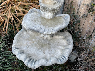
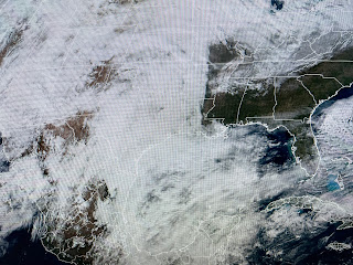
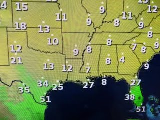
My running bird bath froze solid again much like the other morning when I dropped to 23. While I was 29 in Metairie near I-10 & Bonnabel, MSY claims their low was 32. Just shows you how unrepresentative of the city their reading is. Well, let's get into why the big warm up is coming. It begins out over the Pacific where a krewe of storms is buckling the upper trough back over the West Coast.
As the cold Arctic high slides to the east, winds return off the Gulf. Warmer air is surging into Montana (40s) and Colorado (50s) where several days ago they were way below zero.
You'll notice the change in the way the air feels on Monday as temps bound into the 60s with dew points into the 50s. Zack Fradella timed out the changes this morning of FOX 8.
A warm front will be surging northward over us tomorrow morning and we'll be in the warm air sector most of this week. Note, the GFS model is keeping most of the rain to our west until Wednesday. That front will stall near us for Wednesday into Friday giving us the POTENTIAL for some heavy rain totals.
How much rain could fall over several days? It's still a little early, but models suggest widespread 3-5 with some locations getting 4-6"+.
In the short term, we don't need to worry about that yet as the clouds have moved in, but radar shows the rain way back over Texas.
Since clouds act like a blanket, the freeze threat is over for now. I'm going out into my yard this afternoon to uncover my plants and survey the damage. I'll have before & after pictures on my next post, which won't be until Tuesday. An old rule of thumb is fishing is great immediately following the first warm up after a hard freeze. I'll be out in a boat with Captain Hylton seeing if we can recreate the magic we had last January. With the warm up, dense daily fog will become a problem so get ready for a soupy week. Stay tuned!


No comments:
Post a Comment