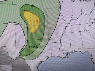
So why & where is the severe threat coming from? Blame it on another western trough that will not cut off like the last low. Newly engaged Hannah Gard put out a FOX 8 First Alert this morning, while SPC moves the severe risk outlook from the Plains on Sunday to over us late Monday into Tuesday.
Hannah outline the timing with the greatest/highest threat coming after dark Monday into predawn on Tuesday.
We are still several days out and the severe risk will change regarding timing. However, we want you to "pay attention" to our next cold front coming early next week. In the short term, it'll be a great day for the Irish/Italian parade in Metairie on Sunday.
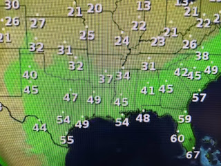
Gosh, I remember being in Ann Arbor back in the late 60s seeing how the South was warming up while the Great Lakes had the lingering chill of Winter. Of note is the bottom graphic (dew points) that has some drier (lower) dew points moving in from the north. It's not drastically drier, but it really felt great walking Bailey this afternoon.


No comments:
Post a Comment