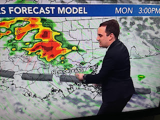
Zack was basing his forecast on what the model developed since it was difficult to see without any fronts around, what's the trigger? That's when I look to the upper air flow.
Dew points are near 70 so there is plenty of low level moisture. As Zack said, it's where the training boundary sets up.
Rainfall totals will generally be 1-2", but IF you get stuck under a band for 1-2 hours, amounts could exceed 3-5"+. Street flooding then is very likely.
The broad brush totals keep the heaviest offshore, but the morning model run had a 3-5" band across the North Shore. Bottom line, I would delay any travel trips around the city to those absolutely necessary.
It's a FIRST ALERT pay attention weather day. Watch where the band of heavy rains develop on your FOX 8 Weather App. The live radar is an excellent tool, plus if warnings are issued, you'll get them instantly on your phone. next post after 4 PM. Stay tuned!


No comments:
Post a Comment