


All we have over the lower 48 states is a fast moving west to east flow with several minor ripples bringing an increase in clouds. The next main storm is still west of California.


Yesterday's cold front has pushed down near the Yucatan with signs of return Gulf moisture rotating around the surface high(Lime Green arrows)


Real Spring-like warmth is surging over the central Plains. It's warmer in Omaha (74) than here. Note the low dew points lingering with the surface high. Coupled with clear skies and light winds overnight, lows will be almost chilly Tuesday morning.


There could be some stray showers Wednesday-Friday, but the main rain threat will come with the next cold front. The difficult forecast question is where will the front stall? South of us? Over us? north of us? Location will make a difference.
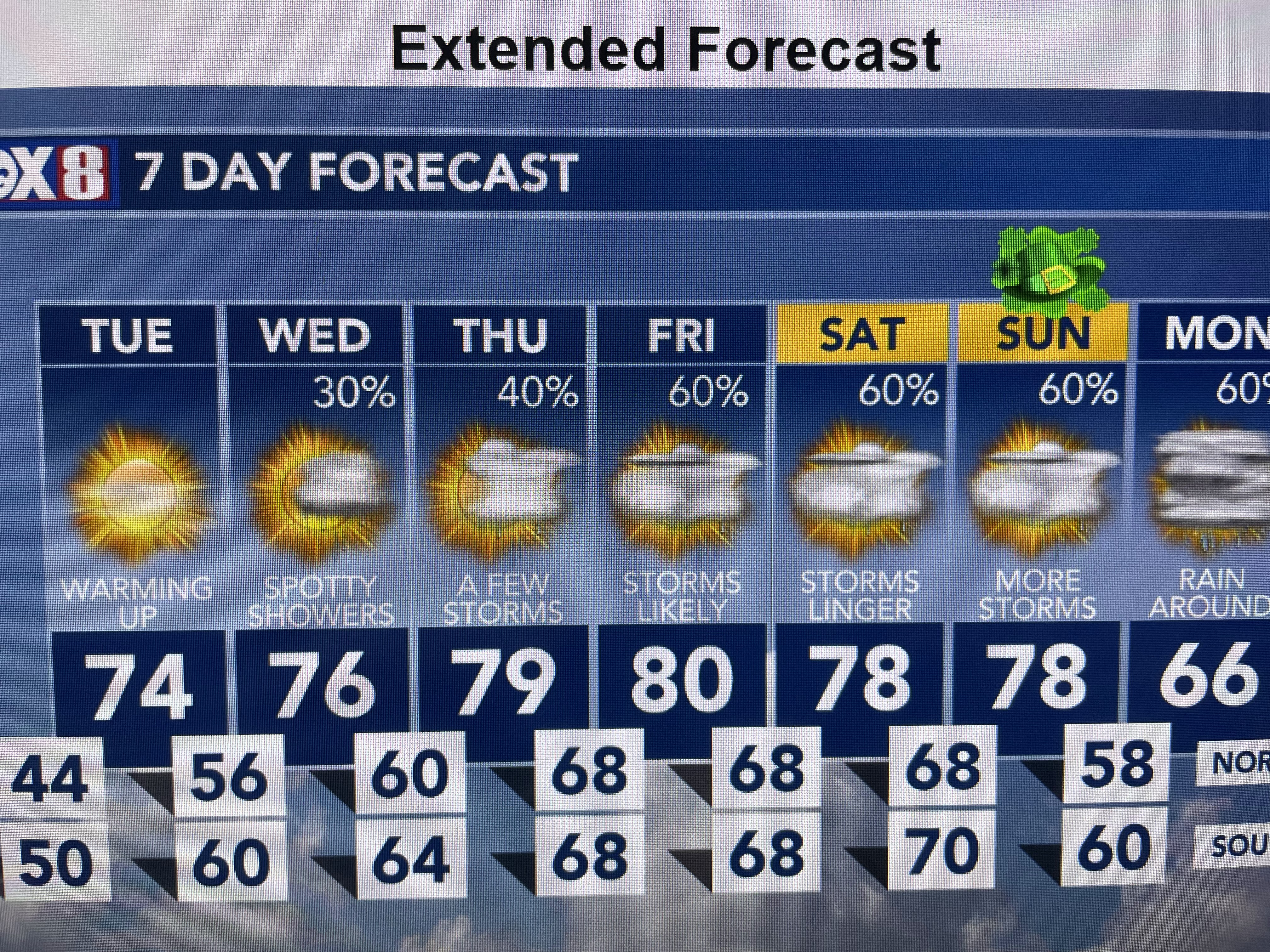


That uncertainty is why there is a FOX 8 First Alert for Friday through Sunday, especially with parades this weekend. IF the front stall far enough to our north, we might not get into the real widespread rainfall until Sunday night into Monday. Don't bet the house on the next 7 day forecast. Finally.


I've posted before that many Hurricane Seasonal Forecasters are calling for a VERY ACTIVE season with 20-30+ named storms. The above graphics show why. The top is the sea surface temperature anomaly for last March with the bottom view this March. Notice a year ago, the Pacific waters were getting very warm (reds & oranges) signaling an El Nino pattern. Despite that, we still had 20 named storms, but only 2 in the Gulf. This March, the colors have flipped with the colder (blues) waters signaling a La Nino is developing. "Usually" La Nino means less wind shear allowing more storms to form. I don't begin to get nervous until 1) the season arrives and 2) a clear pattern develops like last year when most storms turned/recurved before threatening the U.S. We have Hurricane Season. Other parts of the nation have Fire Season, Tornado Season, Avalanche Season. Let's not start the hype before it's necessary. Stay tuned!

No comments:
Post a Comment