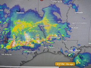
SPC has a level 3 severe risk to our west today shifting to a level 2 risk here tomorrow. In addition, WPC's heavy rainfall totals (4-6")stretch west to east mainly across the North shore.
The question for tonight into Friday is...will the tornado threat be extended over us? Here are the current watches. Red box = Tornado Watch, blue = Severe T-Storm Watch.
Why am I not jumping on the severe/heavy rain threat? Simply because there appears to be great uncertainty as to timing & location.
Let's just pay attention to the forecast tonight into Saturday as it could really turn ugly. Until the upper disturbance gets past us, the surface boundary will focus rounds of heavy rains from Texas to the Florida beaches.
It appears we will dry out some by Sunday. Next week really starts to feel Summer-ish.
The satellite view of the Gulf captures what appears to be lots of smoke coming out of Mexico. The current pattern should keep that south of LA/MS.
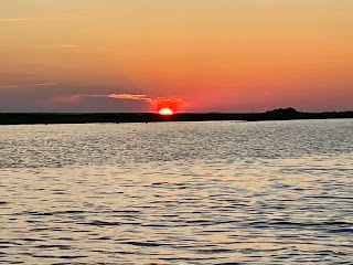
Finally, I went fishing yesterday and today. The sunset & sunrise were terrific while the fishing was OK. However, I did catch my biggest trout ever.


No comments:
Post a Comment