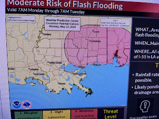
Based on those graphics, it appears the heaviest rain totals are north of Lake Pontchartrain. The reason for the threats? Another series of upper disturbances rotating around that persistent Rockies trough.
This first wave of storms will move through tonight followed by more during the day Monday into Monday night. You'll need to keep up with the weather in case warnings are issued.
You can see temps outside the clouds are in the 80s while where it's raining, temps are in the 60s. As promised, dew points have recovered into the 60s & 70s as the good feel air is gone.
The wettest days appear to be Monday & Friday RIGHT NOW. But we don't want the front to stall anywhere near us so let's keep paying attention until the threats are gone. Stay tuned!


No comments:
Post a Comment