
Yeah I know, ever since the snow & freeze, we've seen Spring-like weather throughout the Gulf South. That has not been the case for most of the nation as old man Winter rolls on. A weak disturbance is bringing another snowstorm to much of the Northeast. Can you imagine how the Eagle's fans feel after enjoying 80-degree warmth here? Hey, They won the Super Bowl so I don't think they mind a little snow!


Snow is falling from Louisville to Cincinnati to D.C. to Philly & NYC. It's a cold rain across states farther to the south. In fact, a cold front is getting very close, but it should stall and lift back to the north tomorrow.


It lifts back to the north as another upper system moves out of the Rockies towards us tomorrow. It will bring the potential for several severe storms late Wednesday mainly after dark. SPC has us in the level 2 (Slight) risk area for Wednesday evening.


This will be the first severe threat this week with another arriving late Saturday. So what's causing all the action from coast to coast? It's disturbances in the upper pattern that are slowly shifting to colder weather for us and most of the nation. You can see the disturbances lined up off the West Coast. After the recent fires, California is on full alert as a strong "Atmospheric River" of moisture will trigger mudslides.

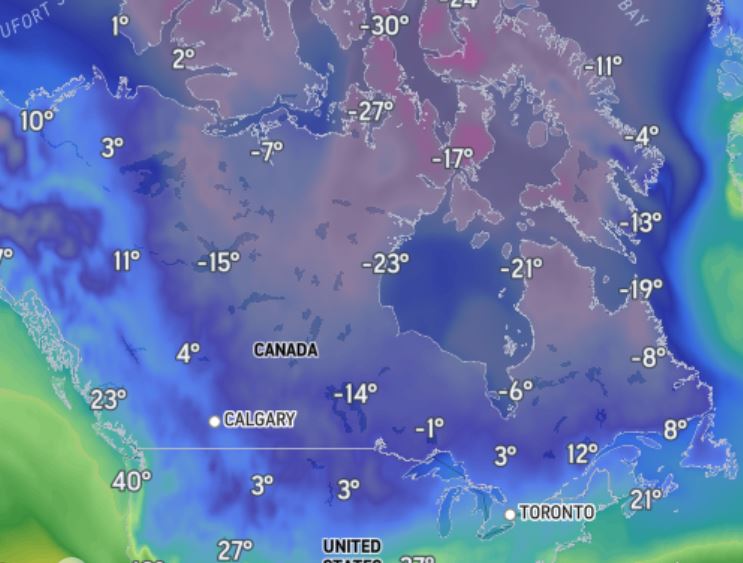
Canada remains locked in Arctic air with many locations well below zero. During the next 14-21 days (thru Mardi Gras), I expect much colder (more average/below normal) temperatures to remind us Spring doesn't arrive until March 21st.


There is the potential for several inches of rain coming with these systems with the heaviest staying to our north. Here is the 7-day predicted rainfall.


The reds & oranges are 3-5"+ totals with amounts generally 1-2" around SE LA/MS. Most of the current rain shield will move north of Lake P. tonight with only a few spotty showers on the South Shore.


Today's high reached 83 breaking the record high of 81 last set back in 1999 & 2020. We could do it again tomorrow before the cool-down brings back sweaters & jackets.

Looking into next week, I don't see a freeze threat coming to the South Shore. The North Shore may get close so gardeners need to pay attention for next week. I really don't want to haul my plants back into my He-Shed. Not as young as I used to be! Stay tuned!
No comments:
Post a Comment