


The arrow points out the norhern circulation and I'll be surprised if it gets a name. If so, it would be another wasted name since it is so far out to sea.


It has several centers right now, but the bottom two graphics are valid for Thursday morning showing a well defined possible hurricane north of West Palm Beach. The blocking high to the north will force whatever forms to track right into Florida.


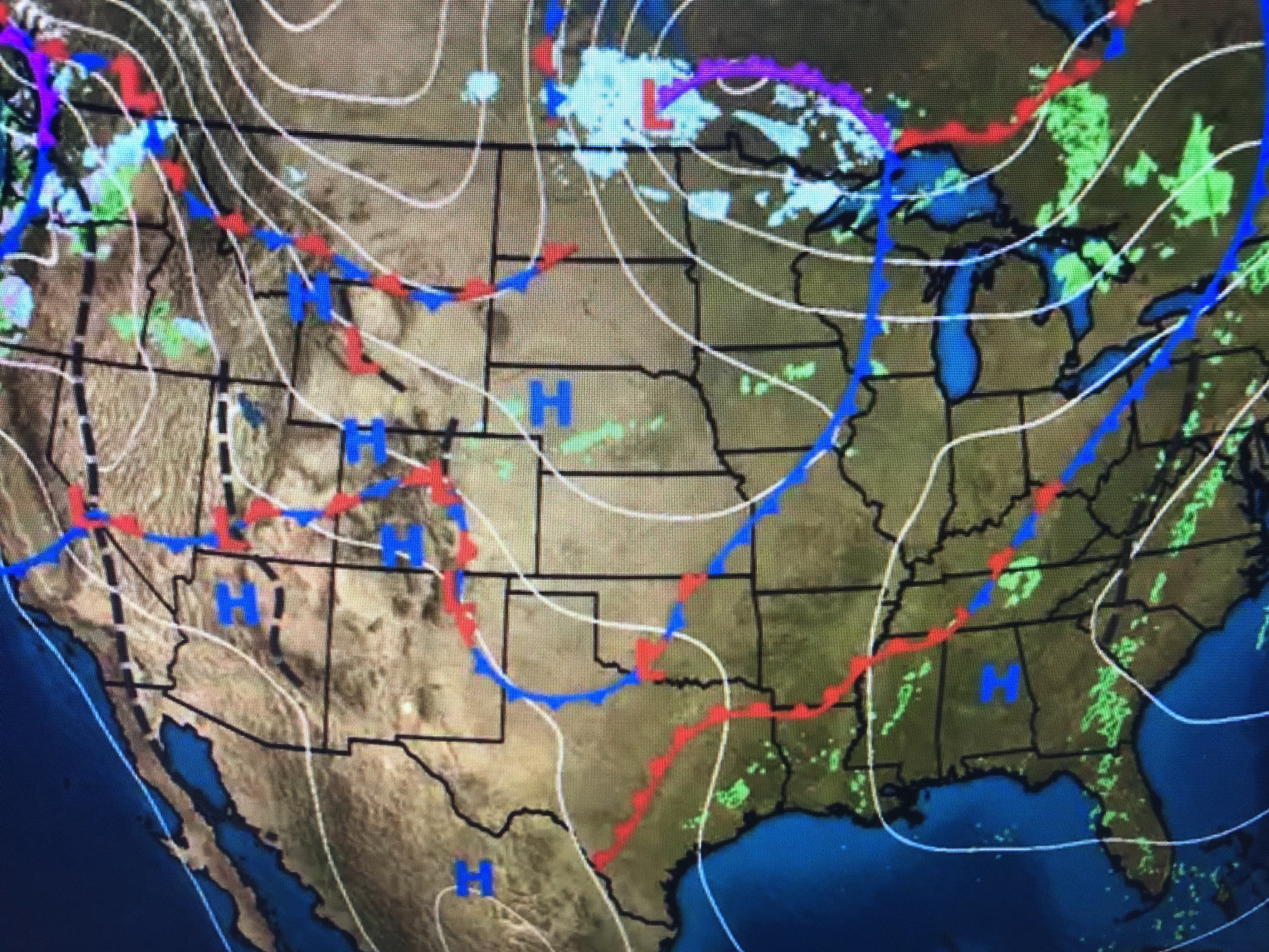
You can see how chilly it is out west while the eastern states are enjoying "Indian Summer" all the way up to Maine. We'll be near record warmth for the next two days with a gradual cooling ahead of the Friday front.


Before any of you point out that Election Day is TUESDAY, I grabbed this graphic from the FOX 8 weather page. Someone will correct it shortly.


Yesterday's front completely dissipated and we never got into the drier air. As the tropical system develops this week, some drier air will begin to wrap around it by Wednesday and you'll notice the difference feel to the air. Finally...


With the shorter days and longer nights, it's getting cold in Alaska & Canada. It's only a matter of time before we'll be whining..."it's too cold!" Stay tuned! LSU/Bama? What a game! Go Tigers!!!

1 comment:
why does the Fox 8 graphic have "VOTE" on Wednesday? Elections are on Tuesday.
Post a Comment