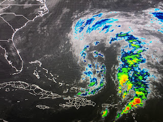
Note in the color IR view, the T-Storms are displaced well away from the center (yellow arrow) in the bottom view. That should change over time as storms begin to fire off around the center.
NHC's latest track brings Nicole to the Florida coast Wednesday night making landfall between Port St. Lucie & West Palm Beach around daybreak on Thursday. If you have any travel plans to Florida east of the beaches, you'll need to pay attention since there will be travel delays/cancellations. For us we have no concerns since another strong cold front is coming that will block Nicole from threatening the Northern Gulf.
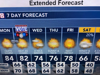
Watching Zack Fradella on FOX 8 this morning where he clearly showed why Nicole will not be our problem. This is a real cold front and will bring back the sweaters and coats this weekend.


No comments:
Post a Comment