

The article talked about how some scientists exaggerate the facts to their benefit. In USA TODAY, the headline screamed about intervening to save the Earth presenting some really wacko "solutions" to slow global warming.


Only one of them makes any sense to me, and that's only if you believe CO2 is driving the current warming CYCLE. It's amazing to me that we NEVER/RARELY get an article (aside from the Forbes' one) that gives "the other side". I've said it before. Follow the money. It's always been about power & control, not about science.
OK, so we have to beat the Vikings. After 2 years ago, I say it's payback time. Saints 38 Vikings 24 with the game not that close. Then we have to go to Green Bay on Jan. 12th. Burrr. I will be focusing on the temperatures in Green Bay once we get by the Vikings. If the game were today, they're 33 degrees with some snow showers. Models suggest much colder air will arrive for the first 2 weeks in January.

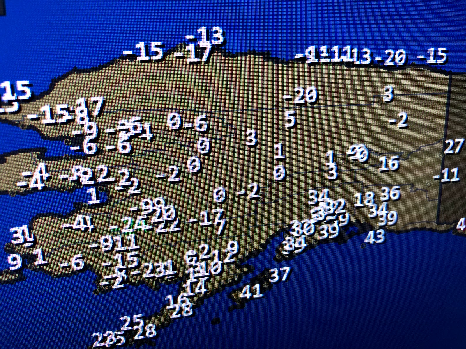
The Super cold air up in Alaska and Canada has moderated some, but it's still below zero.

Another cloud swirl off of California will race eastward and trigger a northern Gulf Low later this week. We could get really stormy for Wednesday night into Thursday with several inches of rain possible. In the short term, Tuesday (NYE) looks terrific with lots of sunshine and highs 55-60 before clouds roll in by late in the day. You can see them showing up along the lower Texas coast heading to the NE.
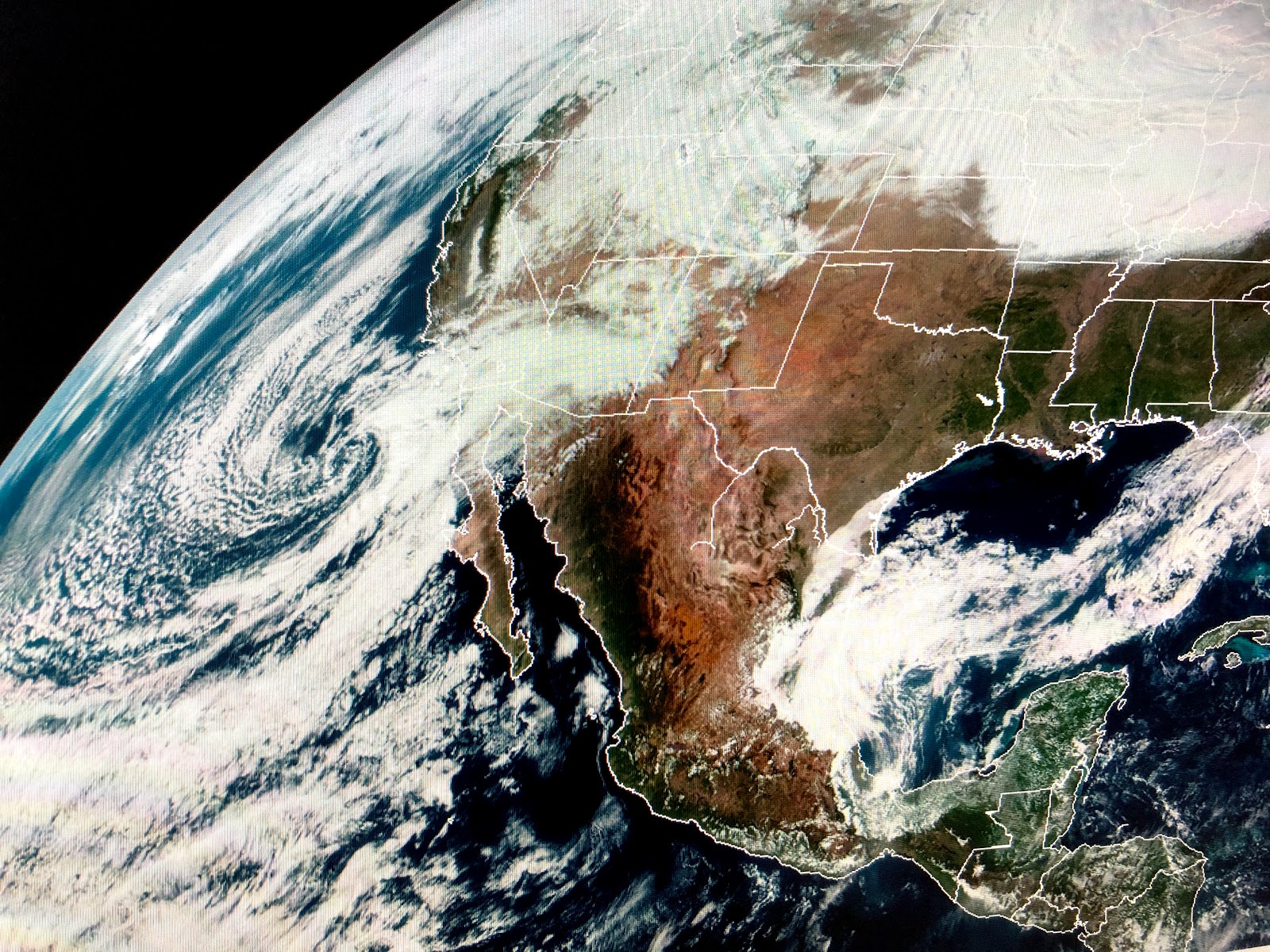


There will be a brief dip in the upper winds late next week that will bring us a freeze threat, but it's still too early to know how cold we'll get. The focus will shift to how stormy we'll be on Thursday after we celebrate welcoming in 2020. Stay tuned!
No comments:
Post a Comment