


Perhaps you heard that the new forecasted crest on the Mississippi River at the Carrollton gage is 17.5' in 2 weeks. That has the Army Corps of Engineers scrambling to open up the Spillway again this coming Friday. Fortunately RIGHT NOW, it appear the opening will only last 2-3 weeks, but this is not good news for local area crabbers & fishermen. The oyster industry east of the river is still dead from last year's opening so more fresh water is certainly not going to help the recovery.


A deep area of low pressure has formed off the east coast and is expected to rotate (make a loop) around for the next 2 days. That should keep our current weather pattern in place with comfy cool nights & warm afternoon. Changes come for Friday and the weekend as several minor upper disturbances increase our clouds, humidity & temperatures. Next week it's back to the 80s.

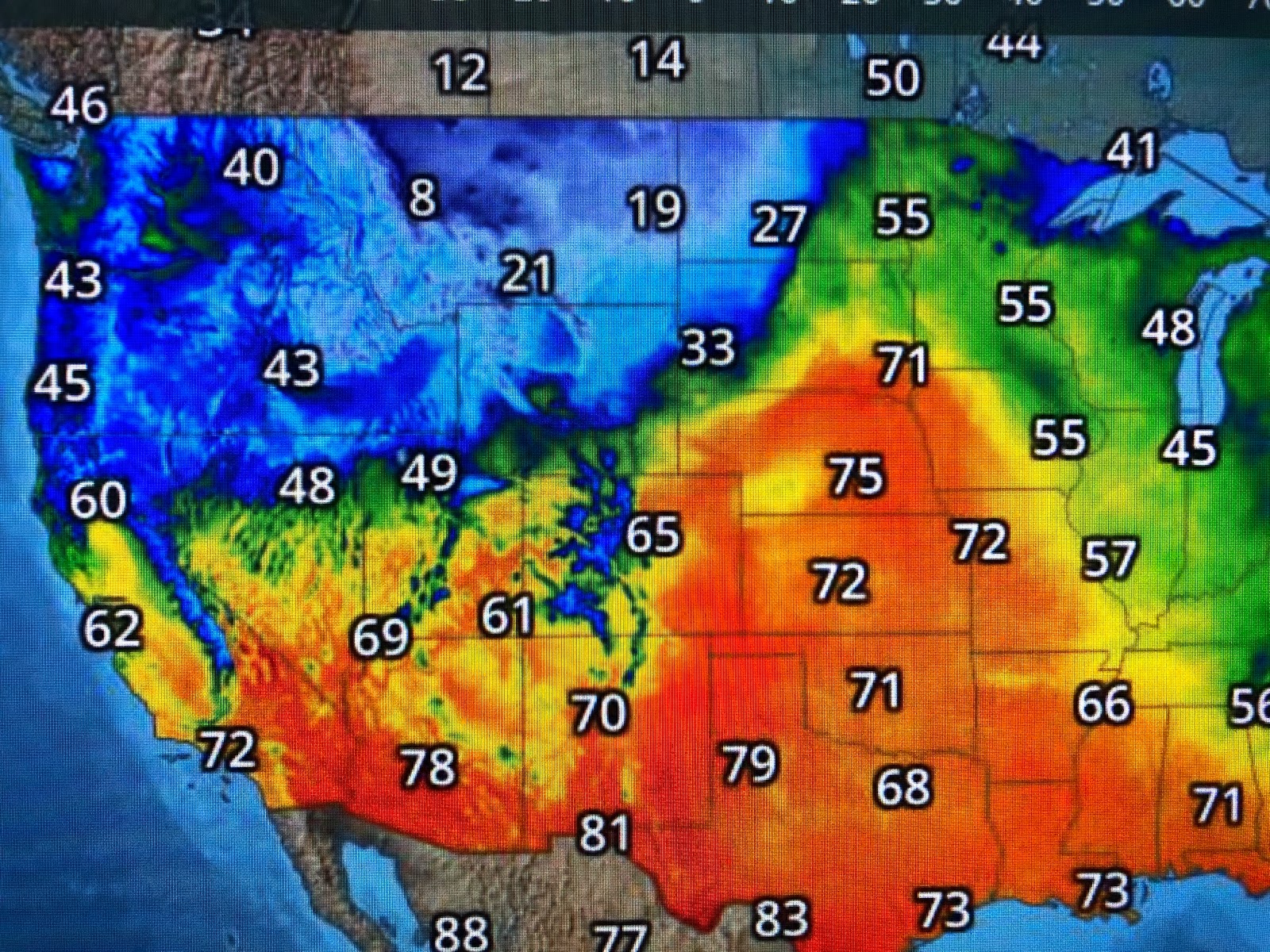
Another western upper trough is forecasted for next week that should continue to keep western states below normal. Look at how chilly it is in Montana with Helena in single digits at mid=afternoon. Burr! That's no April Fool Joke! Stay tuned!
No comments:
Post a Comment