In my morning post I mentioned NHC might make a well defined circulation in the middle of the Atlantic a Tropical Depression before naming it Gonzalo. They did that this afternoon, and by their track and intensity information, we'll be watching Tropical Storm Gonzalo for many days.
Since this system is so far away from any land, I suspect NHC will wait until tomorrow before naming it. Their intensity guidance brings it to the islands on Saturday as a 65 mph Tropical Storm before weakening it as it heads over the eastern Caribbean. We'll be following this system into next week. Closer to home...
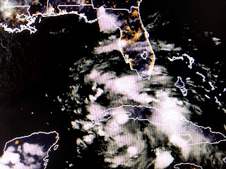
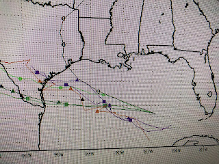
There has been no change in the tropical wave entering the eastern Gulf. The clusters of storms show no organization and NHC keeps the potential for development at 40%. The spaghetti models all keep whatever forms well down across the south central Gulf away from us.
IF it develops, we could see some higher tides along the coasts with a few squalls, but farther north over NOLA, impacts will be minimal. We could quickly have the G & H storms this week. Stay tuned!


No comments:
Post a Comment