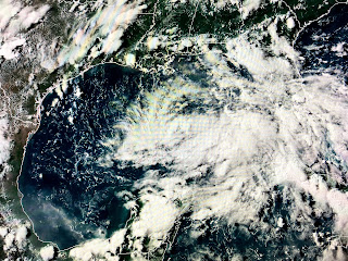
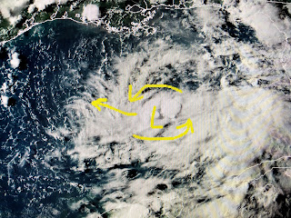
I've delayed my post tonight waiting to see if NHC would make 91L a Tropical Depression, but based on the Recon flight finding limited surface winds, it's still just a Tropical Wave.
Frankly, looking at satellite pics tonight, I've seen lesser organized systems classified as a TD and the recent burst of T-Storms near the guesstimated center tells me we'll have Hanna sometime tomorrow. NHC must feel that too since they've increased the chances for development to 90%.
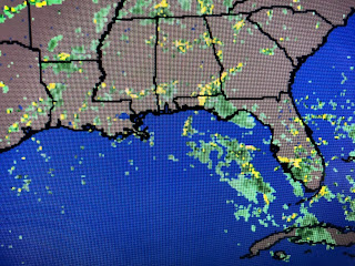
The computer models continue to track whatever forms towards the lower Texas coast and that is where the greatest rain threats will be. If we see a band form over us tomorrow, some folks south of Lake P. could pick up a quick 2-3"+ totals with lesser amounts the farther north you are. Coastal locations will see some higher tides for the next 2 days as the SE flow piles water in from the Gulf.
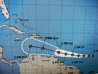
Tropical Storm Gonzalo continues to slowly gain strength and NHC now says it will become our first Hurricane of the 2020 season before it reaches the Windward islands. Computer models weaken him once he gets into the Caribbean and may just become a wave by the time it reaches the western Caribbean. We have plenty of time to watch Mr. G.
For the next 2 days we'll be on the Gulf Watch. NHC may begin issuing advisories (Tropical Storm Watch or warning) tonight or tomorrow under the banner of "potential Tropical Cyclone advisory" just to allow local Emergency Managers in Texas to initiate their Tropical Storm/Hurricane procedures. RIGHT NOW, our only threat is for some heavy rainfall with the main bullseye on south central Texas. Oh, BTW, a Hurricane will be approaching Hawaii, but with Covid-19, who's traveling there on vacation? Stay tuned!


1 comment:
Tell me about the hurricane approaching Hawaii, Bob. My son lives on Kuai.
Post a Comment