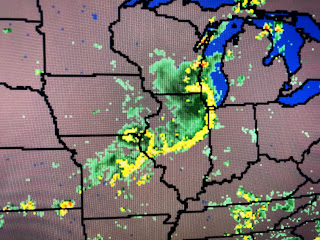
A fast moving line of T-Storms(called a Derecho) produced widespread wind damage across several states late this morning into this evening. It began in Nebraska racing across Iowa and is plowing across Wisconsin, Illinois & Indiana. Those storms are out ahead of a cold front that will stay far to our north.
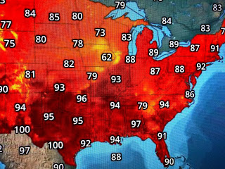
Otherwise, the surface weather map remains basic Summertime with the South hot & humid as usual. An upper high over Texas edged into Louisiana resulting in below normal shower coverage.
The Tropics remain fairly quiet with no strong waves coming off of Africa. However, NHC is watching an area out in the mid Atlantic that they give a 60% chance for development. None of the models are developing any storms for the next 10-14 days.
There is a named storm in the Pacific (Elida), but that's it. An upper low is over the eastern Gulf and if these upper lows hang around for days, they can work their circulation down to the surface. That's highly unlikely and, at the moment, we have nothing to be worried about except the virus, Stay tuned!


No comments:
Post a Comment