

Over night Hurricane Laura has strengthened to a Cat. 3, (115 mph) and that donut hole is beginning to show up.

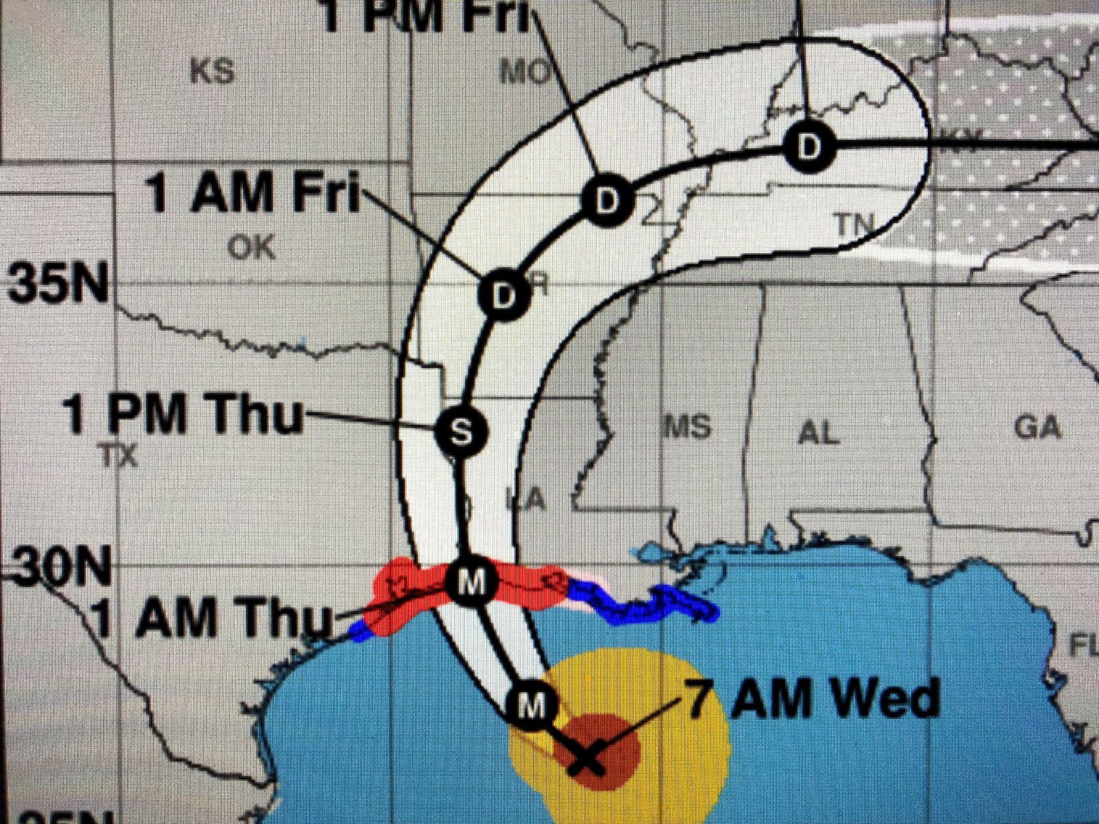


Now that we can track a well defined center (eye), it may appear at times the storm is moving more north than west. That is because major hurricanes do what's called "cycloidal loops" as they move towards landfall. It a pattern seen in a spinning top. The over all forward motion doesn't change and the NHC track error at 24 hours is about 30 miles. I will admit the final track for Marco ended up where the NHC's forecast predicted. However, there was a big difference. When I said "don't ignore the obvious", that referred to the weather/impacts associated with the center which had decoupled/separated from the circulation. The center of Marco followed the NHC track but all of his impacts did not. Hurricane Laura is not fighting the wind shear that tore Marco apart. Her impacts will remain with her track. She has passed 90 degrees west longitude and her forward motion is still fast enough (NW ,310 degrees, @ 15 mph)) so that I can say with 100% certainty Laura is NOT coming to NOLA. Her major impacts will be west of Morgan City, especially west of Abbeville/Lafayette. Let's open your prayer lines as those to our west will need it. Next update before noon. Stay tuned!
14 comments:
New Orleans will be affected by some significant feeder bands tonight and Thursday
Thank you Bob!
Thank you Bob, always look for your updates during inclement weather
staying here in Dulac,La watching the water levels.Not sure what the wind will do? Bob can you tell us what you think.?
Can you provide some more insight for us in Lafayette. College student from NOLA here, trying to see if bunkering down is better than heading back home logistically.
Thanks, Bob! We appreciate you!
Prayers going out to our neighbors to the west. We don't wish a storm on anyone !
My mother’s roof has a leak on the north side, could you please help me figure out the amount of rain coming and when? Need to beat here house when the rains get more frequent
Praying for all who will be impacted. Thanks for the update, Bob!
What is storm surge predictions for Iberia parish near avery island and port of Iberia
Need to drive home from work today. Bilixi to slidell. Am i going to have a problem getting home? Should i leave work early? 430 i leave work and normally get home 530 ish
How did you get the 310 degrees when the rest of us have to deal with nw?
go home to nola, better safe than sorry man.
Post a Comment